ଫାଇଲ:Nepal adm location map.svg

ମୂଳ ଫାଇଲ (SVG ଫାଇଲ, ସାଧାରଣ ମାପ ୧,୧୦୦ × ୭୨୧ ପିକ୍ସେଲ, ଫାଇଲ ଆକାର: ୪୦୩ KB)
This is a file from the Wikimedia Commons. Information from its description page there is shown below. |
ସାରକଥା
| ବିବରଣୀ |
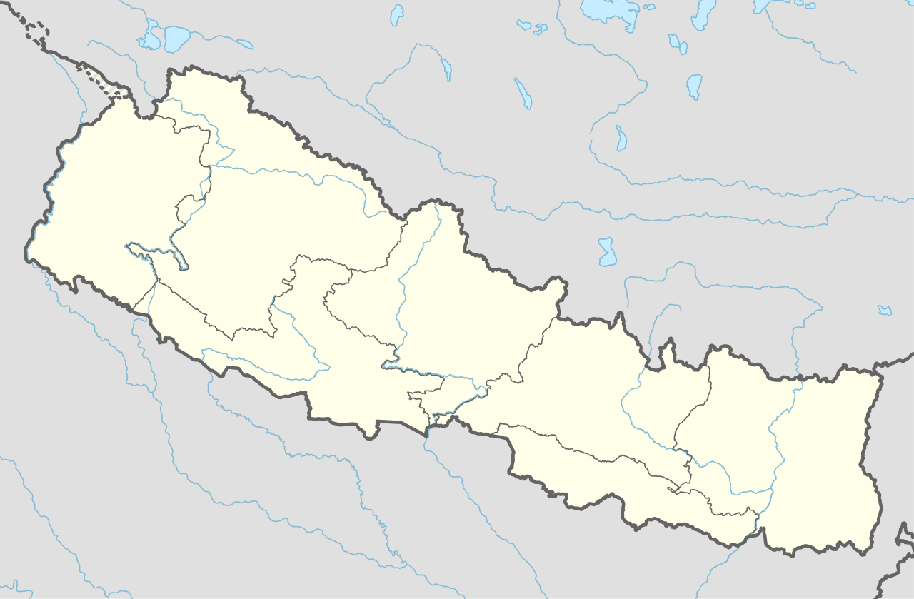
Deutsch: Positionskarte von Nepal
English: Location map of Nepal including the 7 provinces
|
||||||||||||
| ତାରିଖ | |||||||||||||
| ମୂଳାଧାର |
Own work using:
|
||||||||||||
| ଲେଖକ | NordNordWest | ||||||||||||
| ଅନ୍ୟ ସଂସ୍କରଣ |
|
||||||||||||


|
This map has been made or improved in the German Kartenwerkstatt (Map Lab). You can propose maps to improve as well.
|
ସତ୍ଵ
Usage of this file with:

explanatory notes: Legally binding is only the full legalcode. For a free usage I recommend to respect the following licence conditions:
1. Provide my name as given above: NordNordWest,
2. a copy of, or the URI for, the applicable license: https://creativecommons.org/licenses/by-sa/3.0/de/legalcode,
3. the title of the work,
4. in the case of an adaptation, a credit identifying the use of the work in the adaptation.
This license and the rights granted hereunder will terminate automatically upon any breach by you of the terms of this license. Any of the above conditions can be waived if you get permission from the copyright holder. If you have questions or wish differing conditions, please contact me through nnwest or my discussion page ![]() t-online.de
t-online.de
- ଆପଣ ଆରାମରେ:
- ବାଣ୍ଟିପାରିବେ – କାମଟିକୁ ନକଲ କରିପାରିବେ, ବାଣ୍ଟିପାରିବେ ଓ ପ୍ରସାରଣ କରିପାରିବେ
- ମିଶାଇପାରିବେ – କାମଟି ଅଭିଯୋଜନ କରିପାରିବେ
- ତଳଲିଖିତ ସର୍ତ୍ତାବଳୀ ଅଧୀନରେ:
- ଶ୍ରେୟ – ଆପଣ ମନେ କରି ଏହି କାମର ଆବଶ୍ୟକୀୟ ଶ୍ରେୟ ମୂଳ ଗଢ଼ାଳି ବା ସ୍ୱତ୍ୱାଧୀକାରୀଙ୍କୁ ଦେବେ ଏବଂ ଦେଲାବେଳେ ଲାଇସେନ୍ସର ଲିଙ୍କ ଦେଇ କି କି ବଦଳ କଲେ ଉଲ୍ଲେଖ କରିବେ । ଏହା ଉପଯୁକ୍ତ ଢଙ୍ଗରେ କରିବେ କିନ୍ତୁ ଲାଇସେନ୍ସ ଦେଉଥିବା ବ୍ୟକ୍ତି ଆପଣଙ୍କ ପ୍ରଚାର କଲା ଭଳି କିଛି ଲେଖିବେ ନାହିଁ ।
- ସେଆର ଏଲାଇକ – ଯଦି ଆପଣ ଏହି କାମଟିକୁ ବଦଳାଇବେ, ରୂପାନ୍ତରଣ କରିବେ ବା ଏହାକୁ ନେଇ କିଛି ଗଢ଼ିବେ ତେବେ ଆପଣ ଏହାକୁ ଏକା ବା ଅଲଗା ଲାଇସେନ୍ସ ଭିତରେ ରଖିପାରିବେ ।

ଫାଇଲ ଇତିହାସ
ଏହା ଫାଇଲଟି ସେତେବେଳେ ଯେମିତି ଦିଶୁଥିଲା ତାହା ଦେଖିବା ପାଇଁ ତାରିଖ/ବେଳା ଉପରେ କ୍ଲିକ କରନ୍ତୁ
| ତାରିଖ/ବେଳ | ନଖ ଦେଖଣା | ଆକାର | ବ୍ୟବହାରକାରୀ | ମତାମତ | |
|---|---|---|---|---|---|
| ଏବେକାର | ୨୩:୨୯, ୨ ଜୁନ ୨୦୨୦ | | ୧,୧୦୦ × ୭୨୧ (୪୦୩ KB) | NordNordWest | corr |
| ୨୨:୪୩, ୨୨ ମାର୍ଚ୍ଚ ୨୦୨୦ |  | ୧,୧୦୦ × ୭୨୧ (୪୦୧ KB) | NordNordWest | corr | |
| ୨୨:୨୦, ୨୦ ନଭେମ୍ବର ୨୦୧୯ |  | ୧,୧୦୦ × ୭୨୧ (୩୯୮ KB) | NordNordWest | corr | |
| ୦୨:୩୭, ୩ ଜୁନ ୨୦୧୮ |  | ୧,୧୦୦ × ୭୨୧ (୩୯୯ KB) | NordNordWest | == {{int:filedesc}} == {{Information |description= {{de|1=Positionskarte von Nepal}} {{en|1=Location map of Nepal}} {{Location map series N |stretching=114 |top=31.0 |bottom=26.0 |left=79.8 |right=88.5 }} |source={{Own using}} * United States National Imagery and Mapping Agency data |date=2018-06-02 |author={{U|NordNordWest}} |permission= |other_versions= }} {{Kartenwerkstatt}} == {{int:license-header}} == {{User:NordNordWest/LicenceMap}} Category:Location maps of Asia (series N) [[Cate... |
ଫାଇଲ ବ୍ୟବହାର
ଏହି ସବୁ23 ପୃଷ୍ଠାସବୁ ଏହି ଫାଇଲଟିକୁ ଯୋଡ଼ିଥାନ୍ତି:
- କଙ୍କାଳିନୀ ମନ୍ଦିର
- କାଳୀକା ଭଗବତୀ ମନ୍ଦିର
- କୁଷ୍ମାଣ୍ଡ ସରୋବର ତ୍ରିବେଣୀ ଧାମ
- ଗ୍ରାଣ୍ଡ ହୋଟେଲ କାଠମାଣ୍ଡୁ
- ଚଣ୍ଡେଶ୍ଵରୀ ମନ୍ଦିର
- ଚନ୍ଦନନାଥ ମନ୍ଦିର
- ଜାନକୀ ମନ୍ଦିର
- ଡାକ୍ନେଶ୍ଵରୀ ମନ୍ଦିର
- ଡୁଙ୍ଗେଶ୍ଵର ମନ୍ଦିର
- ଦୋଳେଶ୍ଵର ମହାଦେବ ମନ୍ଦିର
- ଧୁଳେଶ୍ଵର
- ପାଦୁକାସ୍ଥାନ
- ବୁଢ଼ା ସୁବ୍ବା ମନ୍ଦିର
- ମଉଳା କାଳୀକା ମନ୍ଦିର
- ମୁସ୍ତାଙ୍ଗ ଗୁମ୍ଫା
- ମନକାମନା ମନ୍ଦିର
- ରାଜଦେବୀ ମନ୍ଦିର
- ଶମ୍ଭୁନାଥ ମନ୍ଦିର
- ସିଦ୍ଧ ବାବା ମନ୍ଦିର
- ଛାଞ୍ଚ:Location map
- ଛାଞ୍ଚ:Location map/doc
- ମଡ୍ୟୁଲ:Location map/data/Nepal
- ମଡ୍ୟୁଲ:Location map/data/Nepal/doc
ଜଗତ ଫାଇଲ ବ୍ୟବହାର
ତଳଲିଖିତ ଉଇକିସବୁ ଏହି ଫାଇଲଟିକୁ ବ୍ୟବହାର କରିଥାନ୍ତି:
- ab.wikipedia.orgରେ ବ୍ୟବହାର
- af.wikipedia.orgରେ ବ୍ୟବହାର
- an.wikipedia.orgରେ ବ୍ୟବହାର
- azb.wikipedia.orgରେ ବ୍ୟବହାର
- az.wikipedia.orgରେ ବ୍ୟବହାର
- ban.wikipedia.orgରେ ବ୍ୟବହାର
- bcl.wikipedia.orgରେ ବ୍ୟବହାର
- be.wikipedia.orgରେ ବ୍ୟବହାର
- bg.wikipedia.orgରେ ବ୍ୟବହାର
- bh.wikipedia.orgରେ ବ୍ୟବହାର
ଏହି ଫାଇଲଟିର ଅଧିକ ବିଶ୍ୱବ୍ୟାପୀ ବ୍ୟବହାର ଦେଖନ୍ତୁ ।