ଫାଇଲ:Nouvelle-Calédonie collectivity location map.svg

Size of this PNG preview of this SVG file: ୮୦୦ × ୨୯୫ ପିକ୍ସେଲ. ବାକି ରେଜୋଲୁସନ: ୩୨୦ × ୧୧୮ ପିକ୍ସେଲ | ୬୪୦ × ୨୩୬ ପିକ୍ସେଲ | ୧,୦୨୪ × ୩୭୭ ପିକ୍ସେଲ | ୧,୨୮୦ × ୪୭୧ ପିକ୍ସେଲ | ୨,୫୬୦ × ୯୪୨ ପିକ୍ସେଲ | ୧,୬୦୮ × ୫୯୨ ପିକ୍ସେଲ.
ମୂଳ ଫାଇଲ (SVG ଫାଇଲ, ସାଧାରଣ ମାପ ୧,୬୦୮ × ୫୯୨ ପିକ୍ସେଲ, ଫାଇଲ ଆକାର: ୨୦୭ KB)
This is a file from the Wikimedia Commons. Information from its description page there is shown below. |
ସାରକଥା
| Camera location | | View this and other nearby images on: OpenStreetMap |
|---|
| ବିବରଣୀ |
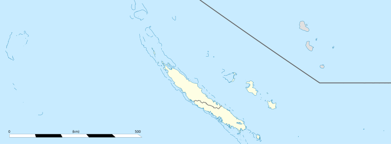
English: Blank administrative map of the territorial collectivity of New Caledonia, France, for geo-location purpose.
This is a general map allowing to geo-locate remote islands. For maps centered on the main islands, see below. Français : Carte administrative vierge de la collectivité territoriale de Nouvelle-Calédonie, France, destinée à la géolocalisation. Ceci est une carte générale permettant la géolocalisation des îles isolées. Pour des cartes centrées sur les îles principales, voir plus bas. Equirectangular projection, WGS84 datum
Geographic limits of the map:
|
||
| ତାରିଖ | |||
| ମୂଳାଧାର |
ଆପଣା କାମ
|
||
| ଲେଖକ | Eric Gaba (Sting - fr:Sting) | ||
| ଅନୁମତି (ଏହି ଫାଇଲକୁ ପୁଣି ବ୍ୟବହାର କରିବେ) |
|
||
| ଅନ୍ୟ ସଂସ୍କରଣ |
|


ସତ୍ଵ
ମୁଁ, ଏହି କାମର ସତ୍ୱାଧିକାରୀ, ଏଠାରେ ତଳଲିଖିତ ଲାଇସେନ୍ସ ଅଧୀନରେ ଏହାକୁ ପ୍ରକାଶ କଲି:
ଏହି ଫାଇଲଟି କ୍ରିଏଟିଭ କମନ୍ସ ଅଧୀନରେ ଆଟ୍ରିବୁସନ ସେଆର-ଏଲାଇକ ୩.୦ ଅନପୋର୍ଟେଡ଼ ଲାଇସେନ୍ସରେ ପଞ୍ଜିକରଣ କରାଯାଇଅଛି ।
- ଆପଣ ଆରାମରେ:
- ବାଣ୍ଟିପାରିବେ – କାମଟିକୁ ନକଲ କରିପାରିବେ, ବାଣ୍ଟିପାରିବେ ଓ ପ୍ରସାରଣ କରିପାରିବେ
- ମିଶାଇପାରିବେ – କାମଟି ଅଭିଯୋଜନ କରିପାରିବେ
- ତଳଲିଖିତ ସର୍ତ୍ତାବଳୀ ଅଧୀନରେ:
- ଶ୍ରେୟ – ଆପଣ ମନେ କରି ଏହି କାମର ଆବଶ୍ୟକୀୟ ଶ୍ରେୟ ମୂଳ ଗଢ଼ାଳି ବା ସ୍ୱତ୍ୱାଧୀକାରୀଙ୍କୁ ଦେବେ ଏବଂ ଦେଲାବେଳେ ଲାଇସେନ୍ସର ଲିଙ୍କ ଦେଇ କି କି ବଦଳ କଲେ ଉଲ୍ଲେଖ କରିବେ । ଏହା ଉପଯୁକ୍ତ ଢଙ୍ଗରେ କରିବେ କିନ୍ତୁ ଲାଇସେନ୍ସ ଦେଉଥିବା ବ୍ୟକ୍ତି ଆପଣଙ୍କ ପ୍ରଚାର କଲା ଭଳି କିଛି ଲେଖିବେ ନାହିଁ ।
- ସେଆର ଏଲାଇକ – ଯଦି ଆପଣ ଏହି କାମଟିକୁ ବଦଳାଇବେ, ରୂପାନ୍ତରଣ କରିବେ ବା ଏହାକୁ ନେଇ କିଛି ଗଢ଼ିବେ ତେବେ ଆପଣ ଏହାକୁ ଏକା ବା ଅଲଗା ଲାଇସେନ୍ସ ଭିତରେ ରଖିପାରିବେ ।

|
ମାଗଣା ସଫ୍ଟବେର ଫାଉଣ୍ଡେସନ ଦେଇ ପ୍ରକାଶିତ କୌଣସି ବଦଳାଇ ନହେବା ଭଳି ଧାରା, ଆଗ ବା ପଛ ପଟ ମଲାଟ ବିନା GNU ଖୋଲା ଦଲିଲକାରଣ ଲାଇସେନ୍ସ ୧.୨ ତମ ସଙ୍କଳନ ବା ଆଉ କୌଣସି ସର୍ତ୍ତାବଳି ଅନୁସାରେ ଏହି ଦଲିଲର ନକଲ, ବଣ୍ଟନ ତଥା/କିମ୍ବା ବଦଳାଇବା ନିମନ୍ତେ ଅନୁମତି ଦିଆଗଲା । GNU ମାଗଣା ଦଲିଲକରଣ ଲାଇସେନ୍ସ ନାମକ ବିଭାଗରେ ଲାଇସେନ୍ସର ନକଲ ଦିଆଯାଇଅଛି । |
ଆପଣ ନିଜ ପସନ୍ଦର ଲାଇସେନ୍ସ ବାଛିପାରିବେ ।
ଫାଇଲ ଇତିହାସ
ଏହା ଫାଇଲଟି ସେତେବେଳେ ଯେମିତି ଦିଶୁଥିଲା ତାହା ଦେଖିବା ପାଇଁ ତାରିଖ/ବେଳା ଉପରେ କ୍ଲିକ କରନ୍ତୁ
| ତାରିଖ/ବେଳ | ନଖ ଦେଖଣା | ଆକାର | ବ୍ୟବହାରକାରୀ | ମତାମତ | |
|---|---|---|---|---|---|
| ଏବେକାର | ୨୦:୫୬, ୪ ଅଗଷ୍ଟ ୨୦୧୩ | ୧,୬୦୮ × ୫୯୨ (୨୦୭ KB) | Szczureq | removed non-existent Sandy Island | |
| ୦୮:୩୭, ୨୧ ଜାନୁଆରୀ ୨୦୦୯ | ୧,୬୦୮ × ୫୯୨ (୧୭୭ KB) | Sting | == Summary == {{Location|20|22|30|S|165|10|30|E|scale:5000000}} <br/> {{Information |Description={{en|Blank administrative map of the territorial collectivity of New Caledonia, France, for |
ଫାଇଲ ବ୍ୟବହାର
ଏହି ଫାଇଲ ସହିତ ଯୋଡ଼ା ଗୋଟିଏ ବି ପୃଷ୍ଠା ନାହିଁ ।
ଜଗତ ଫାଇଲ ବ୍ୟବହାର
ତଳଲିଖିତ ଉଇକିସବୁ ଏହି ଫାଇଲଟିକୁ ବ୍ୟବହାର କରିଥାନ୍ତି:
- ba.wikipedia.orgରେ ବ୍ୟବହାର
- bn.wikipedia.orgରେ ବ୍ୟବହାର
- de.wikipedia.orgରେ ବ୍ୟବହାର
- fr.wikipedia.orgରେ ବ୍ୟବହାର
- Aquarium des lagons
- Îles Chesterfield
- Province Nord (Nouvelle-Calédonie)
- Grande Terre (Nouvelle-Calédonie)
- Nouvelle-Calédonie
- Centre culturel Tjibaou
- Communauté du Pacifique
- Aéroport international de Nouméa-La Tontouta
- Province Sud (Nouvelle-Calédonie)
- Aéroport de Magenta
- Place des Cocotiers
- Géographie de la Nouvelle-Calédonie
- Fayaoué
- Prise d'otages d'Ouvéa
- Hippodrome Henri-Milliard
- Lekine
- Île Hunter (Pacifique Sud)
- Île Matthew
- Île Walpole (Nouvelle-Calédonie)
- Hôpital Gaston-Bourret
- Hôpital de Magenta
- Centre hospitalier territorial Gaston-Bourret de Nouvelle-Calédonie
- Centre hospitalier spécialisé Albert-Bousquet
- Polyclinique de l'Anse Vata
- Clinique Magnin
- Clinique de la Baie des Citrons
- Modèle:Infobox Tribu de Nouvelle-Calédonie
- Barrage de Yaté
- Cœur de Voh
- Expédition d'Entrecasteaux
- Université de la Nouvelle-Calédonie
- Fort Teremba
- Parc zoologique et forestier Michel-Corbasson
- Foire de Bourail
- Plage de Poé
- Modèle:Géolocalisation/Nouvelle-Calédonie
- Stade Numa-Daly
- Wikipédia:Atelier graphique/Cartes/Archives/Demandes mises en sommeil
- Récifs d'Entrecasteaux
- Gossanah
ଏହି ଫାଇଲଟିର ଅଧିକ ବିଶ୍ୱବ୍ୟାପୀ ବ୍ୟବହାର ଦେଖନ୍ତୁ ।