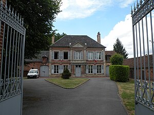
Le Déluge
former commune in Oise, France
ଦୃଷ୍ଟାନ୍ତ
commune of France
ଶେଷ ସମୟ: ୩୧ ଡିସେମ୍ବର 2016
delegated commune
ଆରମ୍ଭ ସମୟ: ୧ ଜାନୁଆରୀ 2017
ସରକାରୀ ନାମ
Le Déluge[୩]
ଦେଶ
ଫ୍ରାନ୍ସ
ପ୍ରଶାସନିକ ବିଭାଗ ଅନ୍ତର୍ଗତ
canton of Noailles
Oise
arrondissement of Beauvais
located in time zone
UTC+01:00
valid in period: standard time
UTC+02:00
valid in period: daylight saving time
associated electoral district
ଭୂଜକୋଟି
office held by head of government
Mayor of Le Déluge
ଲୋକସଂଖ୍ୟା
ସମୁଦ୍ର ପତ୍ତନଠାରୁ ଉଚ୍ଚତା
ପଡ଼ୋଶୀ
Le Coudray-sur-Thelle
Corbeil-Cerf
Laboissière-en-Thelle
La Neuville-d'Aumont
Ressons-l'Abbaye
replaced by
La Drenne
ପତ୍ତନ ବା ଲୁପ୍ତ ହେଲା
୩୧ ଡିସେମ୍ବର 2016
area
୩.୬୯ ବର୍ଗ କିଲୋମିଟର[୫]
ପୋଷ୍ଟାଲ କୋଡ଼
60790[୮]
କମନ୍ସ ଶ୍ରେଣୀ
Le Déluge (Oise)
ବିଷୟର ମୁଖ୍ୟ ଶ୍ରେଣୀ
Category:Le Déluge (Oise)
ଆଧାର
- ↑ Freebase Data Dumps, ୨୮ ଅକ୍ଟୋବର 2013
- ↑ GeoNames
- ↑ Code officiel géographique, https://www.insee.fr/fr/information/4316069, ୨୧ ଅପ୍ରେଲ 2020
- ↑ Code officiel géographique, ୨୨ ସେପ୍ଟେମ୍ବର 2017, https://www.insee.fr/fr/information/2560698
- ↑ ୫.୦ ୫.୧ répertoire géographique des communes, ୨୬ ଅକ୍ଟୋବର 2015
- ↑ Populations légales 2018
- ↑ ୭.୦ ୭.୧ répertoire géographique des communes, https://wxs-telechargement.ign.fr/83edtfdyqte031y0ra49d2e3/telechargement/inspire/RGC-2015-01$RGC2015/file/RGC2015.7z, RGC_2015.txt, 2015, http://web.archive.org/web/20160804005551if_/https://wxs-telechargement.ign.fr/83edtfdyqte031y0ra49d2e3/telechargement/inspire/RGC-2015-01$RGC2015/file/RGC2015.7z
- ↑ dataset of postal codes in France, ୧ ଅକ୍ଟୋବର 2018


