ଫାଇଲ:Trnava Region - physical map.png

ଏହି ଦେଖଣାର ଆକାର: ୪୨୫ × ୫୯୯ ପିକ୍ସେଲ । ବାକି ରେଜୋଲୁସନ: ୧୭୦ × ୨୪୦ ପିକ୍ସେଲ | ୩୪୦ × ୪୮୦ ପିକ୍ସେଲ | ୮୮୦ × ୧,୨୪୦ ପିକ୍ସେଲ.
ମୂଳ ଫାଇଲ (୮୮୦ × ୧,୨୪୦ ପିକସେଲ, ଫାଇଲ ଆକାର: ୬୮୪ KB, ଏମ.ଆଇ.ଏମ.ଇର ପ୍ରକାର: image/png)
This is a file from the Wikimedia Commons. Information from its description page there is shown below. |
| ବିବରଣୀ |
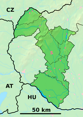
Background map of the Trnava Region, Slovakia, ready for the Geobox template, calibrated at en:Template:Geobox locator Trnava Region Outline map of the Trnava Region, Slovakia, ready for the Geobox template, calibrated at en:Template:Geobox locator Trnava Region |
| ତାରିଖ | (UTC) |
| ମୂଳାଧାର | |
| ଲେଖକ |
|
| This is a retouched picture, which means that it has been digitally altered from its original version. Modifications: fusion. The original can be viewed here: Trnava Region - outline map.svg:
|
ଏହି ଫାଇଲଟି କ୍ରିଏଟିଭ କମନ୍ସ ଅଧୀନରେ ଆଟ୍ରିବୁସନ ସେଆର-ଏଲାଇକ ୩.୦ ଅନପୋର୍ଟେଡ଼ ଲାଇସେନ୍ସରେ ପଞ୍ଜିକରଣ କରାଯାଇଅଛି ।
- ଆପଣ ଆରାମରେ:
- ବାଣ୍ଟିପାରିବେ – କାମଟିକୁ ନକଲ କରିପାରିବେ, ବାଣ୍ଟିପାରିବେ ଓ ପ୍ରସାରଣ କରିପାରିବେ
- ମିଶାଇପାରିବେ – କାମଟି ଅଭିଯୋଜନ କରିପାରିବେ
- ତଳଲିଖିତ ସର୍ତ୍ତାବଳୀ ଅଧୀନରେ:
- ଶ୍ରେୟ – ଆପଣ ମନେ କରି ଏହି କାମର ଆବଶ୍ୟକୀୟ ଶ୍ରେୟ ମୂଳ ଗଢ଼ାଳି ବା ସ୍ୱତ୍ୱାଧୀକାରୀଙ୍କୁ ଦେବେ ଏବଂ ଦେଲାବେଳେ ଲାଇସେନ୍ସର ଲିଙ୍କ ଦେଇ କି କି ବଦଳ କଲେ ଉଲ୍ଲେଖ କରିବେ । ଏହା ଉପଯୁକ୍ତ ଢଙ୍ଗରେ କରିବେ କିନ୍ତୁ ଲାଇସେନ୍ସ ଦେଉଥିବା ବ୍ୟକ୍ତି ଆପଣଙ୍କ ପ୍ରଚାର କଲା ଭଳି କିଛି ଲେଖିବେ ନାହିଁ ।
- ସେଆର ଏଲାଇକ – ଯଦି ଆପଣ ଏହି କାମଟିକୁ ବଦଳାଇବେ, ରୂପାନ୍ତରଣ କରିବେ ବା ଏହାକୁ ନେଇ କିଛି ଗଢ଼ିବେ ତେବେ ଆପଣ ଏହାକୁ ଏକା ବା ଅଲଗା ଲାଇସେନ୍ସ ଭିତରେ ରଖିପାରିବେ ।
ମୂଲ ଅପଲୋଡ଼ ଫାଇଲ
This image is a derivative work of the following images:
- File:Trnava_Region_-_background_map.png licensed with PD-Demis
- 2007-10-27T20:31:17Z Caroig 880x1240 (916063 Bytes)
- 2007-10-27T20:25:24Z Caroig 880x1240 (919490 Bytes) fixed alignment
- 2007-10-27T19:52:08Z Caroig 880x1240 (919490 Bytes) == Summary == {{Information |Description=Background map of the Trnava Region, Slovakia, ready for the [[:en:Template:Geobox|Geobox]] template, calibrated at [[:en:Template:Geobox locator Trnava Region]] |Source=Made my myself
- File:Trnava_Region_-_outline_map.svg licensed with Cc-by-sa-3.0,2.5,2.0,1.0, GFDL
- 2007-10-27T19:50:33Z Caroig 1100x1550 (122371 Bytes) == Summary == {{Information |Description=Outline map of the Trnava Region, Slovakia, ready for the [[:en:Template:Geobox|Geobox]] template, calibrated at [[:en:Template:Geobox locator Trnava Region]] |Source=self-made |Date=2
Uploaded with derivativeFX
ଫାଇଲ ଇତିହାସ
ଏହା ଫାଇଲଟି ସେତେବେଳେ ଯେମିତି ଦିଶୁଥିଲା ତାହା ଦେଖିବା ପାଇଁ ତାରିଖ/ବେଳା ଉପରେ କ୍ଲିକ କରନ୍ତୁ
| ତାରିଖ/ବେଳ | ନଖ ଦେଖଣା | ଆକାର | ବ୍ୟବହାରକାରୀ | ମତାମତ | |
|---|---|---|---|---|---|
| ଏବେକାର | ୦୩:୦୬, ୨୬ ମଇ ୨୦୧୪ | | ୮୮୦ × ୧,୨୪୦ (୬୮୪ KB) | Sudo77(new) | Reverted to version as of 21:28, 25 May 2014 |
| ୦୩:୦୫, ୨୬ ମଇ ୨୦୧୪ |  | ୮୮୦ × ୧,୨୪୦ (୬୮୪ KB) | Sudo77(new) | x | |
| ୦୨:୫୮, ୨୬ ମଇ ୨୦୧୪ |  | ୮୮୦ × ୧,୨୪୦ (୬୮୪ KB) | Sudo77(new) | Trnava Region only | |
| ୨୧:୫୫, ୨୭ ସେପ୍ଟେମ୍ବର ୨୦୧୦ |  | ୮୮୦ × ୧,୨୪୦ (୩.୧୩ MB) | Adehertogh | {{Information |Description=Background map of the Trnava Region, Slovakia, ready for the Geobox template, calibrated at en:Template:Geobox locator Trnava Region Outline map of the Trnava Region, Slovakia, ready for the [[:en:Te |
ଫାଇଲ ବ୍ୟବହାର
ଏହି ଫାଇଲ ସହିତ ଯୋଡ଼ା ଗୋଟିଏ ବି ପୃଷ୍ଠା ନାହିଁ ।
ଜଗତ ଫାଇଲ ବ୍ୟବହାର
ତଳଲିଖିତ ଉଇକିସବୁ ଏହି ଫାଇଲଟିକୁ ବ୍ୟବହାର କରିଥାନ୍ତି:
- bg.wikipedia.orgରେ ବ୍ୟବହାର
- Галанта
- Бродске
- Търнава (Словакия)
- Шаблон:ПК Словакия Търнавски край
- Мостова
- Олдза
- Пиещяни
- Йелка
- Цифер
- Дунайска Стреда
- Водеради
- Серед
- Дехтице
- Смоленице
- Добра вода (Словакия)
- Скалица (Словакия)
- Холич
- Копчани
- Радошовце (окръг Скалица)
- Кути (окръг Сеница)
- Подбранч
- Яблоница
- Приетрж
- Сеница (Словакия)
- Хълбоке
- Градиште под Вратном
- Осуске
- Соботиште
- Приевали
- Долне Дубове
- Болераз
- Катловце
- Букова
- Биньовце
- Богдановце-над-Търнавоу
- Борова (Словакия)
- Брестовани
- Долне Орешани
- Горне Орешани
- Долна Крупа
- Завар
- Бели Костол
- Влъчковце
- Горна Крупа
- Дълга (Словакия)
- Кошолна
- Ружиндол
- Лошонец
- Шелпице
- Шпачинце
ଏହି ଫାଇଲଟିର ଅଧିକ ବିଶ୍ୱବ୍ୟାପୀ ବ୍ୟବହାର ଦେଖନ୍ତୁ ।