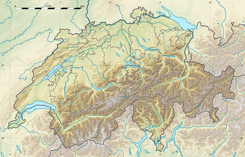
ଫାଇଲ:Switzerland relief location map.jpg

ଏହି ଦେଖଣାର ଆକାର: ୮୦୦ × ୫୧୩ ପିକ୍ସେଲ । ବାକି ରେଜୋଲୁସନ: ୩୨୦ × ୨୦୫ ପିକ୍ସେଲ | ୬୪୦ × ୪୧୦ ପିକ୍ସେଲ | ୧,୦୨୪ × ୬୫୭ ପିକ୍ସେଲ | ୧,୩୪୯ × ୮୬୫ ପିକ୍ସେଲ.
ମୂଳ ଫାଇଲ (୧,୩୪୯ × ୮୬୫ ପିକସେଲ, ଫାଇଲ ଆକାର: ୬୦୨ KB, ଏମ.ଆଇ.ଏମ.ଇର ପ୍ରକାର: image/jpeg)
ଫାଇଲ ଇତିହାସ
ଏହା ଫାଇଲଟି ସେତେବେଳେ ଯେମିତି ଦିଶୁଥିଲା ତାହା ଦେଖିବା ପାଇଁ ତାରିଖ/ବେଳା ଉପରେ କ୍ଲିକ କରନ୍ତୁ
| ତାରିଖ/ବେଳ | ନଖ ଦେଖଣା | ଆକାର | ବ୍ୟବହାରକାରୀ | ମତାମତ | |
|---|---|---|---|---|---|
| ଏବେକାର | ୦୨:୩୪, ୧୮ ଡିସେମ୍ବର ୨୦୧୭ |  | ୧,୩୪୯ × ୮୬୫ (୬୦୨ KB) | Reinhard Kraasch | Verlauf des Doubs korrigiert / Doubs River course retouched |
| ୧୮:୫୮, ୧୯ ଜୁଲାଇ ୨୦୧୦ |  | ୧,୩୪୯ × ୮୬୫ (୪୩୯ KB) | Sting | Color profile | |
| ୧୯:୫୭, ୪ ଡିସେମ୍ବର ୨୦୦୯ |  | ୧,୩୪୯ × ୮୬୫ (୪୫୬ KB) | Sting | == {{int:filedesc}} == {{Location|46|49|30|N|8|15|00|E|scale:1000000}} <br/> {{Information |Description={{de|Relief Positionskarte der Schweiz.}} {{en|Blank physical map of Switzerland, for geo-location purpose.}} {{fr| |
ଫାଇଲ ବ୍ୟବହାର
ଏହି ସବୁ4 ପୃଷ୍ଠାସବୁ ଏହି ଫାଇଲଟିକୁ ଯୋଡ଼ିଥାନ୍ତି:
ଜଗତ ଫାଇଲ ବ୍ୟବହାର
ତଳଲିଖିତ ଉଇକିସବୁ ଏହି ଫାଇଲଟିକୁ ବ୍ୟବହାର କରିଥାନ୍ତି:
- als.wikipedia.orgରେ ବ୍ୟବହାର
- Langensee
- Gotthardpass
- Rheinwaldhorn
- Pfäffikersee
- Sarnersee
- Etzel (Berg)
- Höhronen (Berg)
- Sattel (Pass)
- Churfirsten
- Säntis
- Wohlensee
- Ruine Rifenstein
- Wartenberg (Muttenz)
- Lägern
- Schloss Lenzburg
- Uetliberg
- Schloss Chillon
- Schloss Bottmingen
- Schloss Pratteln
- Ruine Madeln
- Burg Kropfenstein
- Vorlage:Positionskarte Schweiz
- Schloss Klingnau
- Ruine Iberg
- Ruine Besserstein
- Rengg
- Schloss Rümligen
- Pilatus
- Festung Aarburg
- Dufourspitze
- Schloss Schwarzwasserstelz
- Schloss Stein
- Schloss Uster
- Stausee Wettingen
- Grosser St. Bernhard
- Malojapass
- Splügenpass
- Matterhorn
- Schwendisee
- Morgenberghorn
- Ruine Schenkenberg
- Schloss Auenstein
- Schloss Kasteln
- Siggenberg
- Chestenberg
- Bruggerberg
- Wartenberg-Ruinen
- Scheidegg (Tecknau)
- Ruine Münchenstein
- Ruine Farnsburg
ଏହି ଫାଇଲଟିର ଅଧିକ ବିଶ୍ୱବ୍ୟାପୀ ବ୍ୟବହାର ଦେଖନ୍ତୁ ।


