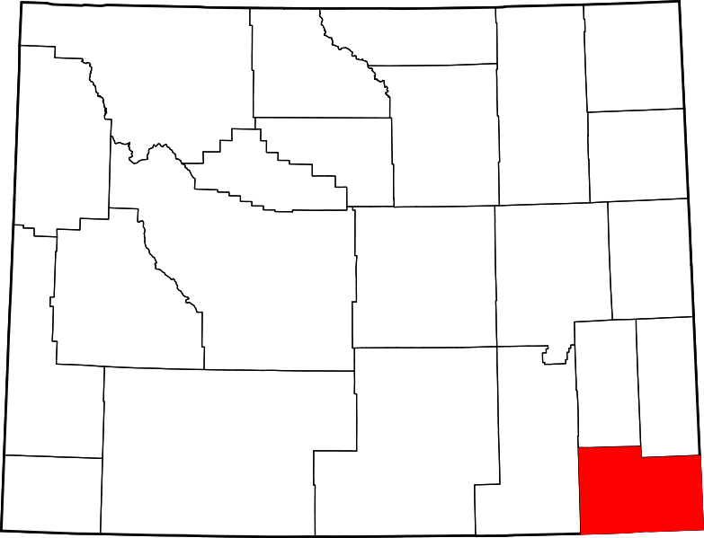
ଫାଇଲ:Map of Wyoming highlighting Laramie County.svg

Size of this PNG preview of this SVG file: ୭୮୩ × ୫୯୯ ପିକ୍ସେଲ. ବାକି ରେଜୋଲୁସନ: ୩୧୪ × ୨୪୦ ପିକ୍ସେଲ | ୬୨୭ × ୪୮୦ ପିକ୍ସେଲ | ୧,୦୦୩ × ୭୬୮ ପିକ୍ସେଲ | ୧,୨୮୦ × ୯୮୦ ପିକ୍ସେଲ | ୨,୫୬୦ × ୧,୯୬୦ ପିକ୍ସେଲ | ୧,୪୭୧ × ୧,୧୨୬ ପିକ୍ସେଲ.
ମୂଳ ଫାଇଲ (SVG ଫାଇଲ, ସାଧାରଣ ମାପ ୧,୪୭୧ × ୧,୧୨୬ ପିକ୍ସେଲ, ଫାଇଲ ଆକାର: ୨୩ KB)
ଫାଇଲ ଇତିହାସ
ଏହା ଫାଇଲଟି ସେତେବେଳେ ଯେମିତି ଦିଶୁଥିଲା ତାହା ଦେଖିବା ପାଇଁ ତାରିଖ/ବେଳା ଉପରେ କ୍ଲିକ କରନ୍ତୁ
| ତାରିଖ/ବେଳ | ନଖ ଦେଖଣା | ଆକାର | ବ୍ୟବହାରକାରୀ | ମତାମତ | |
|---|---|---|---|---|---|
| ଏବେକାର | ୧୬:୩୧, ୨୫ ଜୁନ ୨୦୨୪ |  | ୧,୪୭୧ × ୧,୧୨୬ (୨୩ KB) | Nux | fix rendering (remove clipping) |
| ୧୨:୧୯, ୨୪ ଜୁନ ୨୦୨୪ |  | ୫,୮୮୩ × ୪,୫୦୪ (୨୬ KB) | Mdann52 | Upload new file to correct SVG issue | |
| ୨୩:୫୪, ୧୨ ଫେବୃଆରୀ ୨୦୦୬ |  | ୫,୮୮୩ × ୪,୫୦୪ (୨୬ KB) | David Benbennick | {{subst:User:Dbenbenn/clm|county=Laramie County|state=Wyoming|type=county}} |
ଫାଇଲ ବ୍ୟବହାର
ଏହି ଫାଇଲ ସହିତ ଯୋଡ଼ା ଗୋଟିଏ ବି ପୃଷ୍ଠା ନାହିଁ ।
ଜଗତ ଫାଇଲ ବ୍ୟବହାର
ତଳଲିଖିତ ଉଇକିସବୁ ଏହି ଫାଇଲଟିକୁ ବ୍ୟବହାର କରିଥାନ୍ତି:
- ar.wikipedia.orgରେ ବ୍ୟବହାର
- bg.wikipedia.orgରେ ବ୍ୟବହାର
- bpy.wikipedia.orgରେ ବ୍ୟବହାର
- ca.wikipedia.orgରେ ବ୍ୟବହାର
- cdo.wikipedia.orgରେ ବ୍ୟବହାର
- ceb.wikipedia.orgରେ ବ୍ୟବହାର
- ce.wikipedia.orgରେ ବ୍ୟବହାର
- cy.wikipedia.orgରେ ବ୍ୟବହାର
- de.wikipedia.orgରେ ବ୍ୟବହାର
- en.wikipedia.orgରେ ବ୍ୟବହାର
- List of counties in Wyoming
- Laramie County, Wyoming
- Albin, Wyoming
- Burns, Wyoming
- Fox Farm-College, Wyoming
- Pine Bluffs, Wyoming
- Ranchettes, Wyoming
- South Greeley, Wyoming
- Meriden, Wyoming
- Cheyenne, Wyoming
- Template:Laramie County, Wyoming
- User:Nyttend/County templates/WY
- Carpenter, Wyoming
- Granite, Wyoming
- Hillsdale, Wyoming
- Horse Creek, Wyoming
- National Register of Historic Places listings in Laramie County, Wyoming
- Talk:2009 swine flu pandemic in the United States/Archive 1
- Francis E. Warren Air Force Base
- Category:Populated places in Laramie County, Wyoming
- Hecla, Wyoming
ଏହି ଫାଇଲଟିର ଅଧିକ ବିଶ୍ୱବ୍ୟାପୀ ବ୍ୟବହାର ଦେଖନ୍ତୁ ।