ଫାଇଲ:Map of Hawaii highlighting Hawaii (island).svg

Size of this PNG preview of this SVG file: ୮୦୦ × ୫୩୮ ପିକ୍ସେଲ. ବାକି ରେଜୋଲୁସନ: ୩୨୦ × ୨୧୫ ପିକ୍ସେଲ | ୬୪୦ × ୪୩୧ ପିକ୍ସେଲ | ୧,୦୨୪ × ୬୮୯ ପିକ୍ସେଲ | ୧,୨୮୦ × ୮୬୨ ପିକ୍ସେଲ | ୨,୫୬୦ × ୧,୭୨୩ ପିକ୍ସେଲ | ୬,୦୬୩ × ୪,୦୮୧ ପିକ୍ସେଲ.
ମୂଳ ଫାଇଲ (SVG ଫାଇଲ, ସାଧାରଣ ମାପ ୬,୦୬୩ × ୪,୦୮୧ ପିକ୍ସେଲ, ଫାଇଲ ଆକାର: ୧୨ KB)
This is a file from the Wikimedia Commons. Information from its description page there is shown below. |
.svg)
ସାରକଥା
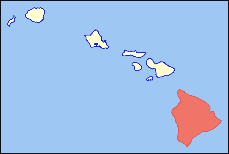
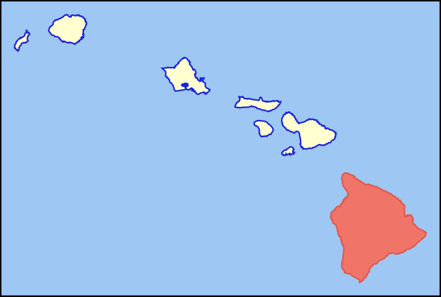
| ବିବରଣୀ | Colored locator map for the island of Hawaii |
| ତାରିଖ | |
| ମୂଳାଧାର | Based on the SVG file that was released to the public domain by David Benbennick at Wikipedia: Image:Map_of_Hawaii_highlighting_Kalawao_County.svg |
| ଲେଖକ | MattWright |
ସତ୍ଵ
| ଏହି କାମଟି ପବ୍ଲିକ ଡୋମେନ ରେ ଏହାର ଗଢ଼ାଳିI, MattWrightଙ୍କ ଦେଇ ପ୍ରକାଶିତ ହେଲା, ଏହା ଜଗତସାରା ଲାଗୁ । କେତେକ ଦେଶରେ ଏହା ନ୍ୟାୟମତେ ଅନୁମୋଦିତ ହୋଇନପାରେ, ଯଦି ସେମିତି ହୁଏ: I, MattWright ଯେ ପର୍ଯ୍ୟନ୍ତ ଆଇନରେ କିଛି ସର୍ତ୍ତ ଦରକାର ନ ପଡ଼େ ସେ ପର୍ଯ୍ୟନ୍ତ ସଭିଙ୍କୁ କୌଣସି ବି ଉଦ୍ଦେଶ୍ୟରେ ଏହ କାମଟିକୁ ନିସର୍ତ୍ତ ବ୍ୟବହାର କରିବାକୁ ଅନୁମତି ଦେଉଛନ୍ତି । |
ଫାଇଲ ଇତିହାସ
ଏହା ଫାଇଲଟି ସେତେବେଳେ ଯେମିତି ଦିଶୁଥିଲା ତାହା ଦେଖିବା ପାଇଁ ତାରିଖ/ବେଳା ଉପରେ କ୍ଲିକ କରନ୍ତୁ
| ତାରିଖ/ବେଳ | ନଖ ଦେଖଣା | ଆକାର | ବ୍ୟବହାରକାରୀ | ମତାମତ | |
|---|---|---|---|---|---|
| ଏବେକାର | ୧୪:୦୩, ୩୦ ଜୁଲାଇ ୨୦୦୭ | | ୬,୦୬୩ × ୪,୦୮୧ (୧୨ KB) | MattWright | == Summary == {{Information |Description=Colored locator map for the island of Kauai |Source=Based on the SVG file that was released to the public domain by [http://commons.wikimedia.org/wiki/User:Dbenbenn David Benbennick] at [http://en.wikipedia.org/wik |
ଫାଇଲ ବ୍ୟବହାର
ଏହି ଫାଇଲ ସହିତ ଯୋଡ଼ା ଗୋଟିଏ ବି ପୃଷ୍ଠା ନାହିଁ ।
ଜଗତ ଫାଇଲ ବ୍ୟବହାର
ତଳଲିଖିତ ଉଇକିସବୁ ଏହି ଫାଇଲଟିକୁ ବ୍ୟବହାର କରିଥାନ୍ତି:
- af.wikipedia.orgରେ ବ୍ୟବହାର
- als.wikipedia.orgରେ ବ୍ୟବହାର
- ar.wikipedia.orgରେ ବ୍ୟବହାର
- az.wiktionary.orgରେ ବ୍ୟବହାର
- bg.wikipedia.orgରେ ବ୍ୟବହାର
- br.wikipedia.orgରେ ବ୍ୟବହାର
- ca.wikipedia.orgରେ ବ୍ୟବହାର
- de.wikipedia.orgରେ ବ୍ୟବହାର
- de.wikivoyage.orgରେ ବ୍ୟବହାର
- el.wikipedia.orgରେ ବ୍ୟବହାର
- en.wikipedia.orgରେ ବ୍ୟବହାର
- eo.wikipedia.orgରେ ବ୍ୟବହାର
- es.wikipedia.orgରେ ବ୍ୟବହାର
- fr.wiktionary.orgରେ ବ୍ୟବହାର
- fy.wikipedia.orgରେ ବ୍ୟବହାର
- ga.wikipedia.orgରେ ବ୍ୟବହାର
- haw.wikipedia.orgରେ ବ୍ୟବହାର
- hi.wikipedia.orgରେ ବ୍ୟବହାର
- hu.wikipedia.orgରେ ବ୍ୟବହାର
- ia.wikipedia.orgରେ ବ୍ୟବହାର
- id.wikipedia.orgରେ ବ୍ୟବହାର
- is.wikipedia.orgରେ ବ୍ୟବହାର
- it.wikivoyage.orgରେ ବ୍ୟବହାର
- ja.wikipedia.orgରେ ବ୍ୟବହାର
- lt.wikipedia.orgରେ ବ୍ୟବହାର
- ms.wikipedia.orgରେ ବ୍ୟବହାର
- pt.wikipedia.orgରେ ବ୍ୟବହାର
- ro.wikipedia.orgରେ ବ୍ୟବହାର
- sk.wikipedia.orgରେ ବ୍ୟବହାର
- sv.wikipedia.orgରେ ବ୍ୟବହାର
- tg.wikipedia.orgରେ ବ୍ୟବହାର
- th.wikipedia.orgରେ ବ୍ୟବହାର
- ur.wikipedia.orgରେ ବ୍ୟବହାର
ଏହି ଫାଇଲଟିର ଅଧିକ ବିଶ୍ୱବ୍ୟାପୀ ବ୍ୟବହାର ଦେଖନ୍ତୁ ।
.svg)
.svg)