ଫାଇଲ:Khyber Pass Area Map.jpg
ବଡ଼ ରେଜୋଲୁସନ ନାହିଁ ।
Khyber_Pass_Area_Map.jpg (୫୦୫ × ୩୧୦ ପିକସେଲ, ଫାଇଲ ଆକାର: ୮୮ KB, ଏମ.ଆଇ.ଏମ.ଇର ପ୍ରକାର: image/jpeg)
This is a file from the Wikimedia Commons. Information from its description page there is shown below. |
| ବିବରଣୀ |
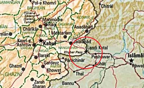
English: Map of Afghanistan
മലയാളം: ഖൈബർ ചുരത്തിനടുത്ത്, പാകിസ്താൻ അഫ്ഘാനിസ്താൻ അതിർത്തിപ്രദേശത്തിന്റെ ഭൂപടം |
| ତାରିଖ | (UTC) |
| ମୂଳାଧାର | |
| ଲେଖକ |
|
| This is a retouched picture, which means that it has been digitally altered from its original version. Modifications: ഖൈബർ ചുരം വളയത്തിലാക്കി. The original can be viewed here: Afghan-big.jpg:
|
| This image is a work of a Central Intelligence Agency employee, taken or made as part of that person's official duties. As a Work of the United States Government, this image or media is in the public domain in the United States.
|

|
ମୂଲ ଅପଲୋଡ଼ ଫାଇଲ
This image is a derivative work of the following images:
- File:Afghan-big.jpg licensed with PD-USGov-CIA
- 2006-12-16T23:24:27Z Electionworld 1378x1480 (348278 Bytes) {{ew|en|Ijomer}} Map of Afghanistan *CREATED/PUBLISHED: Central Intelligence Agency, 1993 *source: http://memory.loc.gov/cgi-bin/query/r?ammem/gmd:@field(NUMBER+@band(g7630+ct000721)) {{PD-USGov-CIA}}
Uploaded with derivativeFX
ଫାଇଲ ଇତିହାସ
ଏହା ଫାଇଲଟି ସେତେବେଳେ ଯେମିତି ଦିଶୁଥିଲା ତାହା ଦେଖିବା ପାଇଁ ତାରିଖ/ବେଳା ଉପରେ କ୍ଲିକ କରନ୍ତୁ
| ତାରିଖ/ବେଳ | ନଖ ଦେଖଣା | ଆକାର | ବ୍ୟବହାରକାରୀ | ମତାମତ | |
|---|---|---|---|---|---|
| ଏବେକାର | ୨୩:୪୬, ୧୨ ଡିସେମ୍ବର ୨୦୧୦ | | ୫୦୫ × ୩୧୦ (୮୮ KB) | Sreejithk2000 | {{Information |Description={{en|Map of Afghanistan}} {{ml|ഖൈബർ ചുരത്തിനടുത്ത്, പാകിസ്താൻ അഫ്ഘാനിസ്താൻ അതിർത്തിപ്രദേശത്തിന |
ଫାଇଲ ବ୍ୟବହାର
ଏହି ସବୁପୃଷ୍ଠା ଏହି ଫାଇଲଟିକୁ ଯୋଡ଼ିଥାନ୍ତି:
ଜଗତ ଫାଇଲ ବ୍ୟବହାର
ତଳଲିଖିତ ଉଇକିସବୁ ଏହି ଫାଇଲଟିକୁ ବ୍ୟବହାର କରିଥାନ୍ତି:
- en.wikipedia.orgରେ ବ୍ୟବହାର
- fa.wikipedia.orgରେ ବ୍ୟବହାର
- hu.wikipedia.orgରେ ବ୍ୟବହାର
- ml.wikipedia.orgରେ ବ୍ୟବହାର
- ur.wikipedia.orgରେ ବ୍ୟବହାର