ଫାଇଲ:Japan natural location map with side map of the Ryukyu Islands.jpg

ଏହି ଦେଖଣାର ଆକାର: ୬୬୪ × ୬୦୦ ପିକ୍ସେଲ । ବାକି ରେଜୋଲୁସନ: ୨୬୬ × ୨୪୦ ପିକ୍ସେଲ | ୫୩୧ × ୪୮୦ ପିକ୍ସେଲ | ୮୫୦ × ୭୬୮ ପିକ୍ସେଲ | ୧,୧୩୩ × ୧,୦୨୪ ପିକ୍ସେଲ | ୨,୪୯୭ × ୨,୨୫୬ ପିକ୍ସେଲ.
ମୂଳ ଫାଇଲ (୨,୪୯୭ × ୨,୨୫୬ ପିକସେଲ, ଫାଇଲ ଆକାର: ୮୩୦ KB, ଏମ.ଆଇ.ଏମ.ଇର ପ୍ରକାର: image/jpeg)
This is a file from the Wikimedia Commons. Information from its description page there is shown below. |
ସାରକଥା
| ବିବରଣୀ |
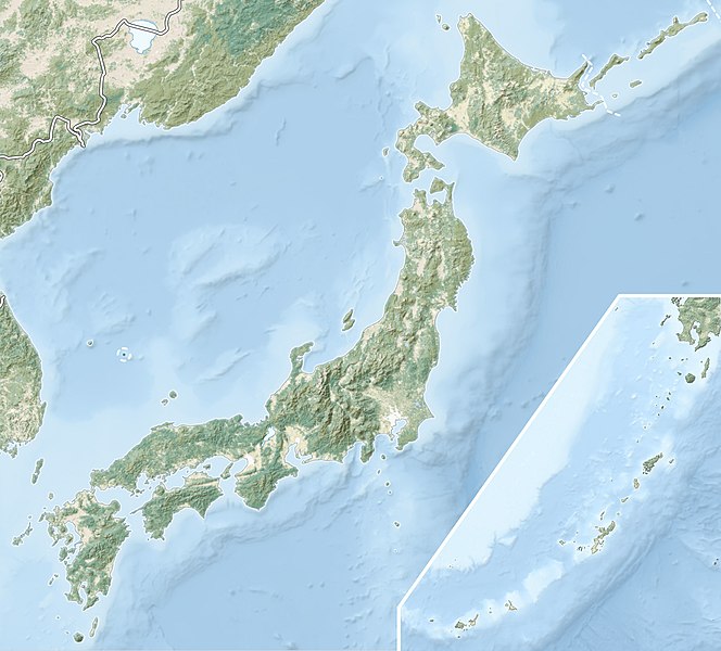
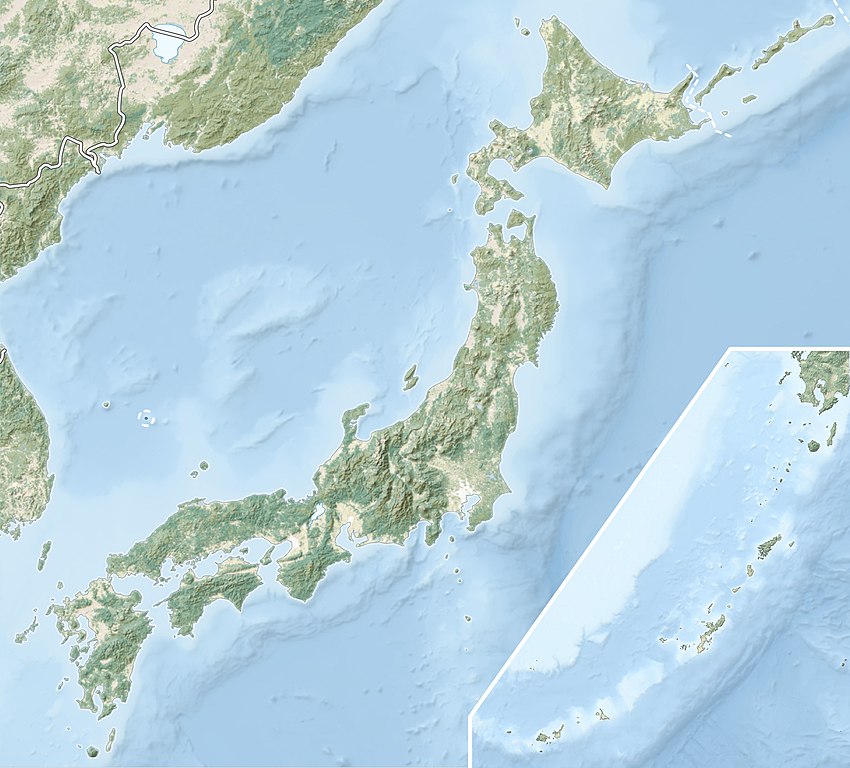
English: Natural Location map of Japan
Equirectangular projection. Geographic limits to locate objects in the main map with the main islands:
Geographic limits to locate objects in the side map with the Ryukyu Islands:
|
||
| ତାରିଖ | |||
| ମୂଳାଧାର |
|
||
| ଲେଖକ | Alexrk2 | ||
| ଅନୁମତି (ଏହି ଫାଇଲକୁ ପୁଣି ବ୍ୟବହାର କରିବେ) |
ଏହି ଫାଇଲଟି କ୍ରିଏଟିଭ କମନ୍ସ ଅଧୀନରେ ଆଟ୍ରିବୁସନ ସେଆର-ଏଲାଇକ ୩.୦ ଅନପୋର୍ଟେଡ଼ ଲାଇସେନ୍ସରେ ପଞ୍ଜିକରଣ କରାଯାଇଅଛି ।
|
||
| ଅନ୍ୟ ସଂସ୍କରଣ |
|


ଫାଇଲ ଇତିହାସ
ଏହା ଫାଇଲଟି ସେତେବେଳେ ଯେମିତି ଦିଶୁଥିଲା ତାହା ଦେଖିବା ପାଇଁ ତାରିଖ/ବେଳା ଉପରେ କ୍ଲିକ କରନ୍ତୁ
| ତାରିଖ/ବେଳ | ନଖ ଦେଖଣା | ଆକାର | ବ୍ୟବହାରକାରୀ | ମତାମତ | |
|---|---|---|---|---|---|
| ଏବେକାର | ୦୩:୧୧, ୧୦ ମାର୍ଚ୍ଚ ୨୦୨୨ | | ୨,୪୯୭ × ୨,୨୫୬ (୮୩୦ KB) | Sting | Natural Earth land cover data for Ryukyu Islands |
| ୧୫:୧୪, ୨୨ ଜୁନ ୨୦୧୮ |  | ୨,୪୯୭ × ୨,୨୫୬ (୭୯୪ KB) | Mardetanha | Reverted to version as of 19:56, 22 March 2011 (UTC) | |
| ୦୧:୨୬, ୨୩ ମାର୍ଚ୍ଚ ୨୦୧୧ |  | ୨,୪୯୭ × ୨,୨୫୬ (୭୯୪ KB) | Alexrk2 | RGB | |
| ୦୦:୩୭, ୨୩ ମାର୍ଚ୍ଚ ୨୦୧୧ |  | ୨,୪୯୭ × ୨,୨୫୬ (୭୪୫ KB) | Chumwa | RGB mode | |
| ୦୨:୩୮, ୨୨ ମାର୍ଚ୍ଚ ୨୦୧୧ |  | ୨,୪୯୭ × ୨,୨୫୬ (୧.୫୪ MB) | Alexrk2 | == {{int:filedesc}} == {{Information |Description= {{en|Natural Location map of Japan Equirectangular projection. Geographic limits to locate objects in the main map with the main islands: * N: 45°51'37" N (45.86°N) * S: 30°01'13" N (30. |
ଫାଇଲ ବ୍ୟବହାର
ଏହି ସବୁ4 ପୃଷ୍ଠାସବୁ ଏହି ଫାଇଲଟିକୁ ଯୋଡ଼ିଥାନ୍ତି:
ଜଗତ ଫାଇଲ ବ୍ୟବହାର
ତଳଲିଖିତ ଉଇକିସବୁ ଏହି ଫାଇଲଟିକୁ ବ୍ୟବହାର କରିଥାନ୍ତି:
- ace.wikipedia.orgରେ ବ୍ୟବହାର
- als.wikipedia.orgରେ ବ୍ୟବହାର
- ar.wikipedia.orgରେ ବ୍ୟବହାର
- arz.wikipedia.orgରେ ବ୍ୟବହାର
- ast.wikipedia.orgରେ ବ୍ୟବହାର
- as.wikipedia.orgରେ ବ୍ୟବହାର
- azb.wikipedia.orgରେ ବ୍ୟବହାର
- az.wikipedia.orgରେ ବ୍ୟବହାର
- Hokkaydo
- Kyuşu
- Fuci
- Honşu
- İtsukuşima
- Asama dağı
- Şablon:Yer xəritəsi Yaponiya
- Tohoku zəlzələsi və sunamisi (2011)
- Fukuşima-1 AES
- Böyük Hanşin zəlzələsi
- Böyük Kanto zəlzələsi
- Hoey zəlzələsi
- Mino-Ovari zəlzələsi (1891)
- Yapon çökəkliyi
- Ryukyu adaları
- Osumi boğazı
- Sanqar boğazı
- Koreya boğazı
- Tsuşima boğazı
- Harim dənizi
- Yatsuşiro dənizi
- Hiuqa dənizi
- Daxili Yapon dənizi
- Atsumi yarımadası
- Naqasaki yarımadası
- İzu yarımadası
- Simabara yarımadası
- Şiretoko yarımadası
- Nosuke yarımadası
ଏହି ଫାଇଲଟିର ଅଧିକ ବିଶ୍ୱବ୍ୟାପୀ ବ୍ୟବହାର ଦେଖନ୍ତୁ ।