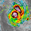
ଫାଇଲ:Winston 2016-02-12 1200Z.png
Winston_2016-02-12_1200Z.png (୬୦୦ × ୬୦୦ ପିକସେଲ, ଫାଇଲ ଆକାର: ୨୭୬ KB, ଏମ.ଆଇ.ଏମ.ଇର ପ୍ରକାର: image/png)
ଫାଇଲ ଇତିହାସ
ଏହା ଫାଇଲଟି ସେତେବେଳେ ଯେମିତି ଦିଶୁଥିଲା ତାହା ଦେଖିବା ପାଇଁ ତାରିଖ/ବେଳା ଉପରେ କ୍ଲିକ କରନ୍ତୁ
| ତାରିଖ/ବେଳ | ନଖ ଦେଖଣା | ଆକାର | ବ୍ୟବହାରକାରୀ | ମତାମତ | |
|---|---|---|---|---|---|
| ଏବେକାର | ୨୨:୫୨, ୩ ମାର୍ଚ୍ଚ ୨୦୧୬ |  | ୬୦୦ × ୬୦୦ (୨୭୬ KB) | Meow | User created page with UploadWizard |
ଫାଇଲ ବ୍ୟବହାର
ଏହି ସବୁପୃଷ୍ଠା ଏହି ଫାଇଲଟିକୁ ଯୋଡ଼ିଥାନ୍ତି:
ଜଗତ ଫାଇଲ ବ୍ୟବହାର
ତଳଲିଖିତ ଉଇକିସବୁ ଏହି ଫାଇଲଟିକୁ ବ୍ୟବହାର କରିଥାନ୍ତି:
- ast.wikipedia.orgରେ ବ୍ୟବହାର
- en.wikipedia.orgରେ ବ୍ୟବହାର
- es.wikipedia.orgରେ ବ୍ୟବହାର
- hi.wikipedia.orgରେ ବ୍ୟବହାର
- nn.wikipedia.orgରେ ବ୍ୟବହାର
- no.wikipedia.orgରେ ବ୍ୟବହାର
- pt.wikipedia.orgରେ ବ୍ୟବହାର
- ru.wikipedia.orgରେ ବ୍ୟବହାର
- uk.wikipedia.orgରେ ବ୍ୟବହାର
- zh.wikipedia.orgରେ ବ୍ୟବହାର


