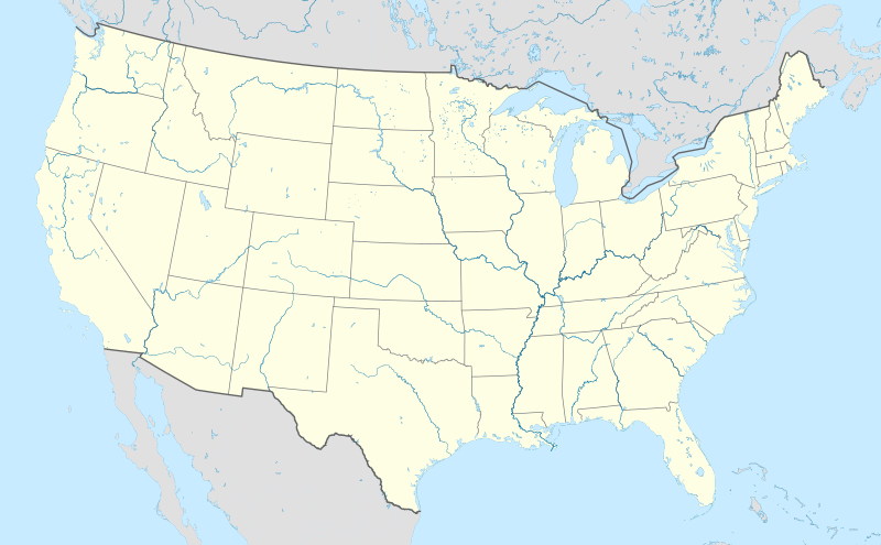
ଫାଇଲ:Usa edcp location map.svg

Size of this PNG preview of this SVG file: ୮୦୦ × ୪୯୫ ପିକ୍ସେଲ. ବାକି ରେଜୋଲୁସନ: ୩୨୦ × ୧୯୮ ପିକ୍ସେଲ | ୬୪୦ × ୩୯୬ ପିକ୍ସେଲ | ୧,୦୨୪ × ୬୩୪ ପିକ୍ସେଲ | ୧,୨୮୦ × ୭୯୨ ପିକ୍ସେଲ | ୨,୫୬୦ × ୧,୫୮୫ ପିକ୍ସେଲ | ୧,୧୮୧ × ୭୩୧ ପିକ୍ସେଲ.
ମୂଳ ଫାଇଲ (SVG ଫାଇଲ, ସାଧାରଣ ମାପ ୧,୧୮୧ × ୭୩୧ ପିକ୍ସେଲ, ଫାଇଲ ଆକାର: ୨.୦୩ MB)
ଫାଇଲ ଇତିହାସ
ଏହା ଫାଇଲଟି ସେତେବେଳେ ଯେମିତି ଦିଶୁଥିଲା ତାହା ଦେଖିବା ପାଇଁ ତାରିଖ/ବେଳା ଉପରେ କ୍ଲିକ କରନ୍ତୁ
| ତାରିଖ/ବେଳ | ନଖ ଦେଖଣା | ଆକାର | ବ୍ୟବହାରକାରୀ | ମତାମତ | |
|---|---|---|---|---|---|
| ଏବେକାର | ୦୨:୧୮, ୩ ଅପ୍ରେଲ ୨୦୨୪ |  | ୧,୧୮୧ × ୭୩୧ (୨.୦୩ MB) | Spesh531 | correction to Rhode Island border. Little Compton and Tiverton was previously shown to be in Massachusetts |
| ୧୦:୪୨, ୭ ଜାନୁଆରୀ ୨୦୧୫ |  | ୧,୧୮୧ × ୭୩୧ (୨.୦୩ MB) | Wereldburger758 | Removal empty elements outside viewbox. Renaming of files. Valid SVG now. | |
| ୨୩:୨୬, ୨୪ ଅଗଷ୍ଟ ୨୦୧୦ |  | ୧,୧୮୧ × ୭୩୧ (୨.୫୭ MB) | Uwe Dedering | coastline was to thin and bahamas pulled out of the atlantic | |
| ୧୬:୦୫, ୨୪ ଅଗଷ୍ଟ ୨୦୧୦ |  | ୧,୧୮୧ × ୭୩୧ (୩.୪୮ MB) | Uwe Dedering | {{Information |Description={{en|1=Location map of the USA (without Hawaii and Alaska). EquiDistantConicProjection : Central parallel : * N: 37.0° N Central meridian : * E: 96.0° W Standard parallels: * 1: 32.0° N * 2: 42.0° N Made with Natural Ea |
ଫାଇଲ ବ୍ୟବହାର
ଏହି ସବୁ10 ପୃଷ୍ଠାସବୁ ଏହି ଫାଇଲଟିକୁ ଯୋଡ଼ିଥାନ୍ତି:
ଜଗତ ଫାଇଲ ବ୍ୟବହାର
ତଳଲିଖିତ ଉଇକିସବୁ ଏହି ଫାଇଲଟିକୁ ବ୍ୟବହାର କରିଥାନ୍ତି:
- ab.wikipedia.orgରେ ବ୍ୟବହାର
- ace.wikipedia.orgରେ ବ୍ୟବହାର
- af.wikipedia.orgରେ ବ୍ୟବହାର
- Barberton (dubbelsinnig)
- Bretton Woods, New Hampshire
- Lake Placid
- Hollywood
- Aberdeen (dubbelsinnig)
- Jamestown, Virginië
- FIFA Sokker-Wêreldbekertoernooi in 1994
- Kategorie:Lughawens in die Verenigde State van Amerika
- Warrenton
- Winston-Salem
- Gettysburg
- Hartford
- Princeton, Wes-Virginië
- Princeton, Illinois
- Princeton, Indiana
- Princeton, Kentucky
- New Brunswick, New Jersey
- Mountain View
- Century City, Los Angeles
- FIFA Sokker-Wêreldbekertoernooi in 2026
- Harding, Minnesota
- Harding, Wisconsin
- Harding Township, New Jersey
- Russian Hill
- Moscow, Idaho
- Asheville
- Coloradorivier (dubbelsinnig)
- Tuscaloosa, Alabama
- Provo
- Verenigde State se nasionale krieketspan
- T20I-wêreldbeker 2024
- Kaap Canaveral- ruimtemagstasie
- Manson-krater
- Gebruiker:Aliwal2012/Lughawens in die VSA
- als.wikipedia.orgରେ ବ୍ୟବହାର
- an.wikipedia.orgରେ ବ୍ୟବହାର
ଏହି ଫାଇଲଟିର ଅଧିକ ବିଶ୍ୱବ୍ୟାପୀ ବ୍ୟବହାର ଦେଖନ୍ତୁ ।

