ଫାଇଲ:Mediterranean Sea East location map.svg

ମୂଳ ଫାଇଲ (SVG ଫାଇଲ, ସାଧାରଣ ମାପ ୯୫୭ × ୭୬୫ ପିକ୍ସେଲ, ଫାଇଲ ଆକାର: ୧୮୬ KB)
This is a file from the Wikimedia Commons. Information from its description page there is shown below. |
ସାରକଥା
| ବିବରଣୀ |
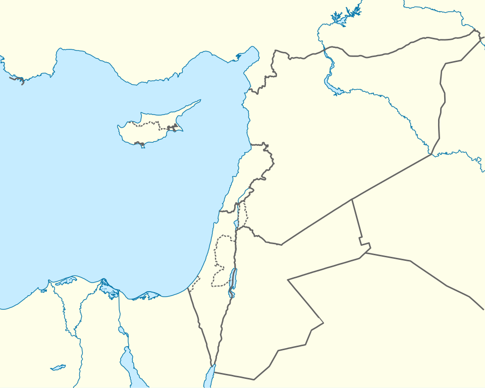
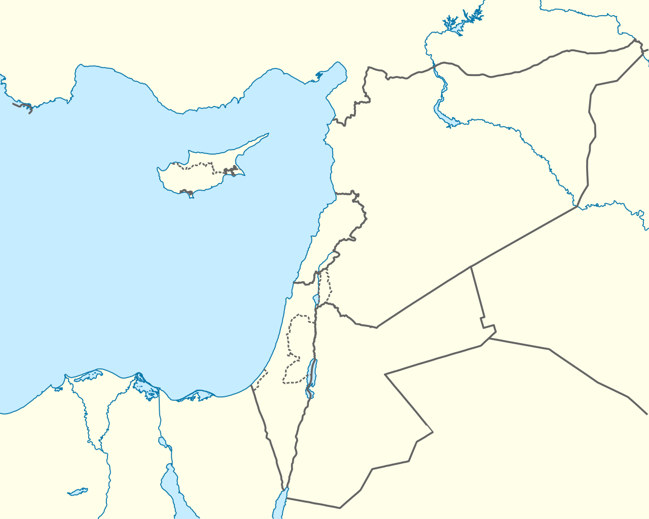
Deutsch: Positionskarte des östlichen Mittelmeers
Quadratische Plattkarte, N-S-Streckung 120 %. Geographische Begrenzung der Karte:
English: Location map of the Eastern Mediterranean Sea
Equirectangular projection, N/S stretching 120 %. Geographic limits of the map:
|
|
| ତାରିଖ | ||
| ମୂଳାଧାର | Own work using: World Data Base II data | |
| ଲେଖକ | NordNordWest | |
| ଅନୁମତି (ଏହି ଫାଇଲକୁ ପୁଣି ବ୍ୟବହାର କରିବେ) |
ଏହି ଫାଇଲଟି କ୍ରିଏଟିଭ କମନ୍ସ ଅଧୀନରେ ଆଟ୍ରିବୁସନ ସେଆର-ଏଲାଇକ ୩.୦ ଜର୍ମାନୀ ଲାଇସେନ୍ସରେ ପଞ୍ଜିକରଣ କରାଯାଇଅଛି ।
 |


|
This map has been made or improved in the German Kartenwerkstatt (Map Lab). You can propose maps to improve as well.
|
ସତ୍ଵ
- ଆପଣ ଆରାମରେ:
- ବାଣ୍ଟିପାରିବେ – କାମଟିକୁ ନକଲ କରିପାରିବେ, ବାଣ୍ଟିପାରିବେ ଓ ପ୍ରସାରଣ କରିପାରିବେ
- ମିଶାଇପାରିବେ – କାମଟି ଅଭିଯୋଜନ କରିପାରିବେ
- ତଳଲିଖିତ ସର୍ତ୍ତାବଳୀ ଅଧୀନରେ:
- ଶ୍ରେୟ – ଆପଣ ମନେ କରି ଏହି କାମର ଆବଶ୍ୟକୀୟ ଶ୍ରେୟ ମୂଳ ଗଢ଼ାଳି ବା ସ୍ୱତ୍ୱାଧୀକାରୀଙ୍କୁ ଦେବେ ଏବଂ ଦେଲାବେଳେ ଲାଇସେନ୍ସର ଲିଙ୍କ ଦେଇ କି କି ବଦଳ କଲେ ଉଲ୍ଲେଖ କରିବେ । ଏହା ଉପଯୁକ୍ତ ଢଙ୍ଗରେ କରିବେ କିନ୍ତୁ ଲାଇସେନ୍ସ ଦେଉଥିବା ବ୍ୟକ୍ତି ଆପଣଙ୍କ ପ୍ରଚାର କଲା ଭଳି କିଛି ଲେଖିବେ ନାହିଁ ।
- ସେଆର ଏଲାଇକ – ଯଦି ଆପଣ ଏହି କାମଟିକୁ ବଦଳାଇବେ, ରୂପାନ୍ତରଣ କରିବେ ବା ଏହାକୁ ନେଇ କିଛି ଗଢ଼ିବେ ତେବେ ଆପଣ ଏହାକୁ ଏକା ବା ଅଲଗା ଲାଇସେନ୍ସ ଭିତରେ ରଖିପାରିବେ ।
ଫାଇଲ ଇତିହାସ
ଏହା ଫାଇଲଟି ସେତେବେଳେ ଯେମିତି ଦିଶୁଥିଲା ତାହା ଦେଖିବା ପାଇଁ ତାରିଖ/ବେଳା ଉପରେ କ୍ଲିକ କରନ୍ତୁ
| ତାରିଖ/ବେଳ | ନଖ ଦେଖଣା | ଆକାର | ବ୍ୟବହାରକାରୀ | ମତାମତ | |
|---|---|---|---|---|---|
| ଏବେକାର | ୨୨:୫୮, ୩ ଅପ୍ରେଲ ୨୦୧୩ | | ୯୫୭ × ୭୬୫ (୧୮୬ KB) | NordNordWest | =={{int:filedesc}}== {{Information |Description= {{de|Positionskarte des östlichen Mittelmeers}} Quadratische Plattkarte, N-S-Streckung 120 %. Geographische Begrenzung der Karte: * N: 38.0° N * S: 29.0° N * W: 29.0° O * O: 42.5°... |
ଫାଇଲ ବ୍ୟବହାର
ଏହି ସବୁ3 ପୃଷ୍ଠାସବୁ ଏହି ଫାଇଲଟିକୁ ଯୋଡ଼ିଥାନ୍ତି:
ଜଗତ ଫାଇଲ ବ୍ୟବହାର
ତଳଲିଖିତ ଉଇକିସବୁ ଏହି ଫାଇଲଟିକୁ ବ୍ୟବହାର କରିଥାନ୍ତି:
- ast.wikipedia.orgରେ ବ୍ୟବହାର
- Episkopí
- Acrotiri (pueblu)
- Nicosia
- Limasol
- Famagusta
- Módulu:Mapa de llocalización/datos/Xipre
- Módulu:Mapa de llocalización/datos/Xipre/usu
- Aeropuertu Internacional de Lárnaca
- Aeropuertu Internacional de Pafos
- Aeropuertu d'Ercan
- Aeropuertu de Nicosia
- Base Aérea de Geçitkale
- Puertu de Limasol
- Pelendri
- Kantou
- Mouttagiaka
- Paramali
- Platres
- Pano Polemidia
- Kato Kivides
- Pissouri
- Omodos
- Platanisteia
- Kolossi
- Kyperounta
- Foini
- Pachna
- Palodia
- Palaiomylos
- Pera Pedi
- Monagroulli
- Paramytha
- Pentakomo
- Parekklisia
- Moniatis
- Prastio (Avdimou)
- Potamitissa
- Potamiou
- Asgata
- Prodromos
- Trachoni
- Vouni
- Armenokhori
- Vikla
- Vasa Koilaniou
- Vasa Kellakiou
- Tserkezoi
- Trimiklini
- Treis Elies
- Sykopetra
ଏହି ଫାଇଲଟିର ଅଧିକ ବିଶ୍ୱବ୍ୟାପୀ ବ୍ୟବହାର ଦେଖନ୍ତୁ ।