ଫାଇଲ:Japan satellite.jpg

ଏହି ଦେଖଣାର ଆକାର: ୬୫୮ × ୬୦୦ ପିକ୍ସେଲ । ବାକି ରେଜୋଲୁସନ: ୨୬୩ × ୨୪୦ ପିକ୍ସେଲ | ୫୨୭ × ୪୮୦ ପିକ୍ସେଲ | ୮୪୩ × ୭୬୮ ପିକ୍ସେଲ | ୧,୧୨୪ × ୧,୦୨୪ ପିକ୍ସେଲ | ୧,୫୫୭ × ୧,୪୧୯ ପିକ୍ସେଲ.
ମୂଳ ଫାଇଲ (୧,୫୫୭ × ୧,୪୧୯ ପିକସେଲ, ଫାଇଲ ଆକାର: ୯୪୯ KB, ଏମ.ଆଇ.ଏମ.ଇର ପ୍ରକାର: image/jpeg)
This is a file from the Wikimedia Commons. Information from its description page there is shown below. |
ସାରକଥା
| ବିବରଣୀ |
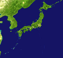
English: Satelllite image of Japan |
| ତାରିଖ | |
| ମୂଳାଧାର | http://visibleearth.nasa.gov/images/2433/land_shallow_topo_21600.tif |
| ଲେଖକ | NASA |
| ଅନ୍ୟ ସଂସ୍କରଣ |

.png)
| This file is in the public domain in the United States because it was solely created by NASA. NASA copyright policy states that "NASA material is not protected by copyright unless noted". (See Template:PD-USGov, NASA copyright policy page or JPL Image Use Policy.) | ||
 |
Warnings:
|
ଫାଇଲ ଇତିହାସ
ଏହା ଫାଇଲଟି ସେତେବେଳେ ଯେମିତି ଦିଶୁଥିଲା ତାହା ଦେଖିବା ପାଇଁ ତାରିଖ/ବେଳା ଉପରେ କ୍ଲିକ କରନ୍ତୁ
| ତାରିଖ/ବେଳ | ନଖ ଦେଖଣା | ଆକାର | ବ୍ୟବହାରକାରୀ | ମତାମତ | |
|---|---|---|---|---|---|
| ଏବେକାର | ୧୩:୩୪, ୧୯ ଅଗଷ୍ଟ ୨୦୦୫ | | ୧,୫୫୭ × ୧,୪୧୯ (୯୪୯ KB) | っ | source: http://visibleearth.nasa.gov/images/2433/land_shallow_topo_21600.tif {{PD-USGov-NASA}} Category:Maps of Japan |
ଫାଇଲ ବ୍ୟବହାର
ଏହି ସବୁପୃଷ୍ଠା ଏହି ଫାଇଲଟିକୁ ଯୋଡ଼ିଥାନ୍ତି:
ଜଗତ ଫାଇଲ ବ୍ୟବହାର
ତଳଲିଖିତ ଉଇକିସବୁ ଏହି ଫାଇଲଟିକୁ ବ୍ୟବହାର କରିଥାନ୍ତି:
- ar.wikipedia.orgରେ ବ୍ୟବହାର
- ckb.wikipedia.orgରେ ବ୍ୟବହାର
- cv.wikipedia.orgରେ ବ୍ୟବହାର
- en.wikipedia.orgରେ ବ୍ୟବହାର
- en.wiktionary.orgରେ ବ୍ୟବହାର
- fr.wikipedia.orgରେ ବ୍ୟବହାର
- incubator.wikimedia.orgରେ ବ୍ୟବହାର
- ja.wikibooks.orgରେ ବ୍ୟବହାର
- ja.wikinews.orgରେ ବ୍ୟବହାର
- pl.wikipedia.orgରେ ବ୍ୟବହାର
- si.wiktionary.orgରେ ବ୍ୟବହାର
- zh-yue.wikipedia.orgରେ ବ୍ୟବହାର
- zh.wikipedia.orgରେ ବ୍ୟବହାର
- zh.wiktionary.orgରେ ବ୍ୟବହାର