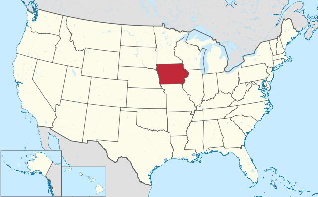
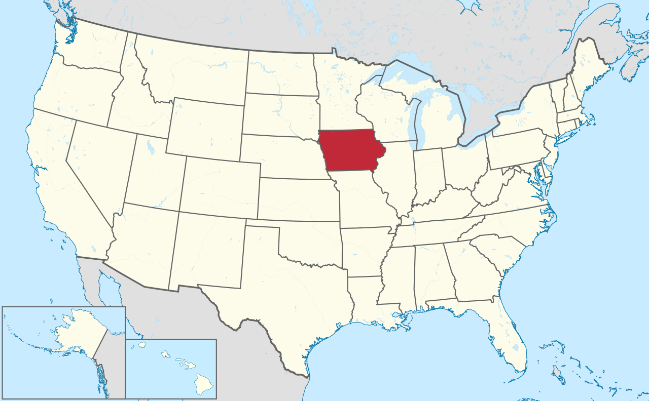
ଫାଇଲ:Iowa in United States.svg

Size of this PNG preview of this SVG file: ୮୦୦ × ୪୯୫ ପିକ୍ସେଲ. ବାକି ରେଜୋଲୁସନ: ୩୨୦ × ୧୯୮ ପିକ୍ସେଲ | ୬୪୦ × ୩୯୬ ପିକ୍ସେଲ | ୧,୦୨୪ × ୬୩୪ ପିକ୍ସେଲ | ୧,୨୮୦ × ୭୯୨ ପିକ୍ସେଲ | ୨,୫୬୦ × ୧,୫୮୫ ପିକ୍ସେଲ | ୧,୧୮୧ × ୭୩୧ ପିକ୍ସେଲ.
ମୂଳ ଫାଇଲ (SVG ଫାଇଲ, ସାଧାରଣ ମାପ ୧,୧୮୧ × ୭୩୧ ପିକ୍ସେଲ, ଫାଇଲ ଆକାର: ୩.୪୬ MB)
This is a file from the Wikimedia Commons. Information from its description page there is shown below. |
ସାରକଥା
| ବିବରଣୀ |
Deutsch: Lage von Iowa in den Vereinigten Staaten.
English: Location of state of Iowa in the United States. |
| ତାରିଖ | |
| ମୂଳାଧାର |
ଆପଣା କାମ |
| ଲେଖକ |
TUBS |
| SVG genesis | This oversized W3C-invalid locator map was created with Adobe Illustrator by TUBS, and with Inkscape. This large W3C-invalid SVG locator map was uploaded with Commonist. This Adobe SVG locator map is very large because TUBS kept the superfluous Adobe PGF or other CDATA garbage . |
ସତ୍ଵ
ମୁଁ, ଏହି କାମର ସତ୍ଵାଧିକାରୀ, ଏଠାରେ ତଳଲିଖିତ ଲାଇସେନ୍ସ ଅଧୀନରେ ଏହାକୁ ପ୍ରକାଶ କଲି:
ଏହି ଫାଇଲଟି କ୍ରିଏଟିଭ କମନ୍ସ ଅଧୀନରେ ଆଟ୍ରିବୁସନ ସେଆର-ଏଲାଇକ ୩.୦ ଅନପୋର୍ଟେଡ଼ ଲାଇସେନ୍ସରେ ପଞ୍ଜିକରଣ କରାଯାଇଅଛି ।
- ଆପଣ ଆରାମରେ:
- ବାଣ୍ଟିପାରିବେ – କାମଟିକୁ ନକଲ କରିପାରିବେ, ବାଣ୍ଟିପାରିବେ ଓ ପ୍ରସାରଣ କରିପାରିବେ
- ମିଶାଇପାରିବେ – କାମଟି ଅଭିଯୋଜନ କରିପାରିବେ
- ତଳଲିଖିତ ସର୍ତ୍ତାବଳୀ ଅଧୀନରେ:
- ଶ୍ରେୟ – ଆପଣ ମନେ କରି ଏହି କାମର ଆବଶ୍ୟକୀୟ ଶ୍ରେୟ ମୂଳ ଗଢ଼ାଳି ବା ସ୍ୱତ୍ୱାଧୀକାରୀଙ୍କୁ ଦେବେ ଏବଂ ଦେଲାବେଳେ ଲାଇସେନ୍ସର ଲିଙ୍କ ଦେଇ କି କି ବଦଳ କଲେ ଉଲ୍ଲେଖ କରିବେ । ଏହା ଉପଯୁକ୍ତ ଢଙ୍ଗରେ କରିବେ କିନ୍ତୁ ଲାଇସେନ୍ସ ଦେଉଥିବା ବ୍ୟକ୍ତି ଆପଣଙ୍କ ପ୍ରଚାର କଲା ଭଳି କିଛି ଲେଖିବେ ନାହିଁ ।
- ସେଆର ଏଲାଇକ – ଯଦି ଆପଣ ଏହି କାମଟିକୁ ବଦଳାଇବେ, ରୂପାନ୍ତରଣ କରିବେ ବା ଏହାକୁ ନେଇ କିଛି ଗଢ଼ିବେ ତେବେ ଆପଣ ଏହାକୁ ଏକା ବା ଅଲଗା ଲାଇସେନ୍ସ ଭିତରେ ରଖିପାରିବେ ।

|
I'd greatly appreciate, that you attribute this media file to Wikimedia Commons, if used outside Wikipedia or Commons. For use in publications such as books, newspapers, blogs, websites, please insert here the following line:
|
ଫାଇଲ ଇତିହାସ
ଏହା ଫାଇଲଟି ସେତେବେଳେ ଯେମିତି ଦିଶୁଥିଲା ତାହା ଦେଖିବା ପାଇଁ ତାରିଖ/ବେଳା ଉପରେ କ୍ଲିକ କରନ୍ତୁ
| ତାରିଖ/ବେଳ | ନଖ ଦେଖଣା | ଆକାର | ବ୍ୟବହାରକାରୀ | ମତାମତ | |
|---|---|---|---|---|---|
| ଏବେକାର | ୨୨:୧୫, ୩୦ ଜୁଲାଇ ୨୦୧୧ | | ୧,୧୮୧ × ୭୩୧ (୩.୪୬ MB) | TUBS |
ଫାଇଲ ବ୍ୟବହାର
ଏହି ସବୁପୃଷ୍ଠା ଏହି ଫାଇଲଟିକୁ ଯୋଡ଼ିଥାନ୍ତି:
ଜଗତ ଫାଇଲ ବ୍ୟବହାର
ତଳଲିଖିତ ଉଇକିସବୁ ଏହି ଫାଇଲଟିକୁ ବ୍ୟବହାର କରିଥାନ୍ତି:
- am.wikipedia.orgରେ ବ୍ୟବହାର
- ang.wikipedia.orgରେ ବ୍ୟବହାର
- ar.wikipedia.orgରେ ବ୍ୟବହାର
- ary.wikipedia.orgରେ ବ୍ୟବହାର
- arz.wikipedia.orgରେ ବ୍ୟବହାର
- ast.wikipedia.orgରେ ବ୍ୟବହାର
- azb.wikipedia.orgରେ ବ୍ୟବହାର
- آیووا
- موسکاتین بؤلگهسی، ایووا
- دالاس بؤلگهسی، ایووا
- وارن بؤلگهسی، ایووا
- واشینقتون بؤلگهسی، ایووا
- دز موینز بؤلگهسی، ایووا
- دیکینزون بؤلگهسی، ایووا
- بنتون بؤلگهسی، ایووا
- پولک بؤلگهسی، ایووا
- بلک هاوک بؤلگهسی، ایووا
- برمر بؤلگهسی، ایووا
- قروندی بؤلگهسی، ایووا
- قوتری بؤلگهسی، ایووا
- وودبوری بؤلگهسی، ایووا
- کلای بؤلگهسی، ایووا
- وورت بؤلگهسی، ایووا
- ایسکات بؤلگهسی، ایووا
- جفرزون بؤلگهسی، ایووا
- جانسون بؤلگهسی، ایووا
- جونز بؤلگهسی، ایووا
- لی بؤلگهسی، ایووا
- مادیسون بؤلگهسی، ایووا
- لوییا بؤلگهسی، ایووا
- az.wikipedia.orgରେ ବ୍ୟବହାର
- bat-smg.wikipedia.orgରେ ବ୍ୟବହାର
- be.wikipedia.orgରେ ବ୍ୟବହାର
- bg.wikipedia.orgରେ ବ୍ୟବହାର
- bs.wikipedia.orgରେ ବ୍ୟବହାର
- ca.wikipedia.orgରେ ବ୍ୟବହାର
- cbk-zam.wikipedia.orgରେ ବ୍ୟବହାର
- cdo.wikipedia.orgରେ ବ୍ୟବହାର
- ceb.wikipedia.orgରେ ବ୍ୟବହାର
- ckb.wikipedia.orgରେ ବ୍ୟବହାର
- crh.wikipedia.orgରେ ବ୍ୟବହାର
- cs.wikipedia.orgରେ ବ୍ୟବହାର
- cy.wikipedia.orgରେ ବ୍ୟବହାର
ଏହି ଫାଇଲଟିର ଅଧିକ ବିଶ୍ୱବ୍ୟାପୀ ବ୍ୟବହାର ଦେଖନ୍ତୁ ।