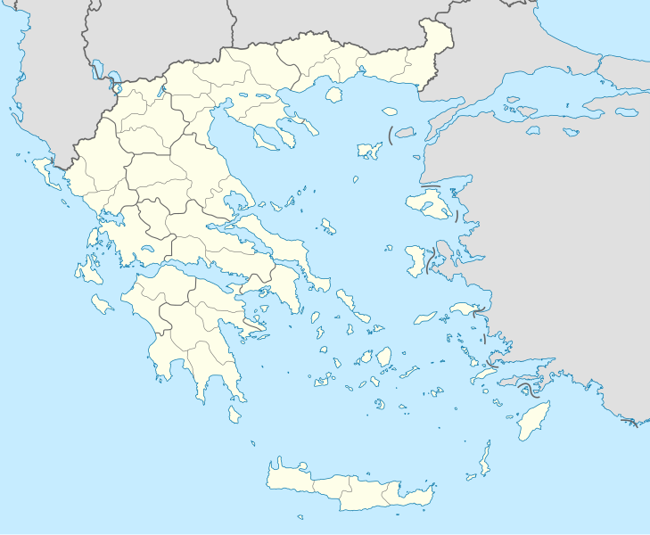
ଫାଇଲ:Greece location map.svg

Size of this PNG preview of this SVG file: ୭୨୯ × ୬୦୦ ପିକ୍ସେଲ. ବାକି ରେଜୋଲୁସନ: ୨୯୨ × ୨୪୦ ପିକ୍ସେଲ | ୫୮୪ × ୪୮୦ ପିକ୍ସେଲ | ୯୩୪ × ୭୬୮ ପିକ୍ସେଲ | ୧,୨୪୫ × ୧,୦୨୪ ପିକ୍ସେଲ | ୨,୪୯୦ × ୨,୦୪୮ ପିକ୍ସେଲ | ୧,୦୦୩ × ୮୨୫ ପିକ୍ସେଲ.
ମୂଳ ଫାଇଲ (SVG ଫାଇଲ, ସାଧାରଣ ମାପ ୧,୦୦୩ × ୮୨୫ ପିକ୍ସେଲ, ଫାଇଲ ଆକାର: ୮୩୩ KB)
ଫାଇଲ ଇତିହାସ
ଏହା ଫାଇଲଟି ସେତେବେଳେ ଯେମିତି ଦିଶୁଥିଲା ତାହା ଦେଖିବା ପାଇଁ ତାରିଖ/ବେଳା ଉପରେ କ୍ଲିକ କରନ୍ତୁ
| ତାରିଖ/ବେଳ | ନଖ ଦେଖଣା | ଆକାର | ବ୍ୟବହାରକାରୀ | ମତାମତ | |
|---|---|---|---|---|---|
| ଏବେକାର | ୦୬:୪୩, ୧୦ ଡିସେମ୍ବର ୨୦୧୫ |  | ୧,୦୦୩ × ୮୨୫ (୮୩୩ KB) | SilentResident | Reverted to version as of 16:28, 11 September 2008 (UTC) The Prefectures became Regional Administrative Units with the same borders |
| ୦୪:୦୩, ୧୯ ଡିସେମ୍ବର ୨୦୧୦ |  | ୧,୦୦୩ × ୮୨୫ (୬୭୩ KB) | Pitichinaccio | Prefecture borders removed. The prefectures of Greece were suppressed in 2010. Präfekturgrenzen entfernt. Die griechischen Präfekturen wurde 2010 abgeschafft. | |
| ୨୧:୫୮, ୧୧ ସେପ୍ଟେମ୍ବର ୨୦୦୮ |  | ୧,୦୦୩ × ୮୨୫ (୮୩୩ KB) | Lencer | {{Information |Description= |Source= |Date= |Author= |Permission= |other_versions= }} | |
| ୧୭:୪୩, ୧୬ ଅଗଷ୍ଟ ୨୦୦୮ |  | ୧,୦୦୩ × ୮୨୫ (୮୧୮ KB) | Lencer | {{Information |Description= |Source= |Date= |Author= |Permission= |other_versions= }} | |
| ୨୩:୫୬, ୨୩ ଜୁଲାଇ ୨୦୦୮ |  | ୮୬୯ × ୭୧୫ (୮୨୩ KB) | Lencer | {{Information |Description= |Source= |Date= |Author= |Permission= |other_versions= }} | |
| ୨୩:୪୧, ୨୩ ଜୁଲାଇ ୨୦୦୮ |  | ୮୬୯ × ୭୧୫ (୮୨୩ KB) | Lencer | {{Information |Description= {{de|Positionskarte von Griechenland}} Quadratische Plattkarte, N-S-Streckung 120 %. Geographische Begrenzung der Karte: * N: 42.0° N * S: 34.6° N * W: 19.1° O * O: 29.9° O {{en|Location map of |
ଫାଇଲ ବ୍ୟବହାର
ଏହି ସବୁ4 ପୃଷ୍ଠାସବୁ ଏହି ଫାଇଲଟିକୁ ଯୋଡ଼ିଥାନ୍ତି:
ଜଗତ ଫାଇଲ ବ୍ୟବହାର
ତଳଲିଖିତ ଉଇକିସବୁ ଏହି ଫାଇଲଟିକୁ ବ୍ୟବହାର କରିଥାନ୍ତି:
- af.wikipedia.orgରେ ବ୍ୟବହାର
- als.wikipedia.orgରେ ବ୍ୟବହାର
- am.wikipedia.orgରେ ବ୍ୟବହାର
- an.wikipedia.orgରେ ବ୍ୟବହାର
- ar.wikipedia.orgରେ ବ୍ୟବହାର
ଏହି ଫାଇଲଟିର ଅଧିକ ବିଶ୍ୱବ୍ୟାପୀ ବ୍ୟବହାର ଦେଖନ୍ତୁ ।


