ଫାଇଲ:Europe blank laea location map.svg

Size of this PNG preview of this SVG file: ୭୦୧ × ୫୯୯ ପିକ୍ସେଲ. ବାକି ରେଜୋଲୁସନ: ୨୮୧ × ୨୪୦ ପିକ୍ସେଲ | ୫୬୧ × ୪୮୦ ପିକ୍ସେଲ | ୮୯୮ × ୭୬୮ ପିକ୍ସେଲ | ୧,୧୯୮ × ୧,୦୨୪ ପିକ୍ସେଲ | ୨,୩୯୫ × ୨,୦୪୮ ପିକ୍ସେଲ | ୧,୪୦୧ × ୧,୧୯୮ ପିକ୍ସେଲ.
ମୂଳ ଫାଇଲ (SVG ଫାଇଲ, ସାଧାରଣ ମାପ ୧,୪୦୧ × ୧,୧୯୮ ପିକ୍ସେଲ, ଫାଇଲ ଆକାର: ୧.୪୨ MB)
This is a file from the Wikimedia Commons. Information from its description page there is shown below. |
Bosnia
ସାରକଥା
| ବିବରଣୀ |
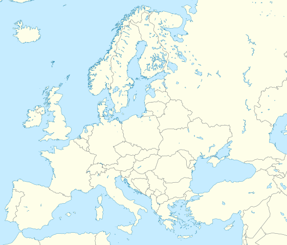
Deutsch: Positionskarte Europa; Politisch mit Staatsgrenzen; Flächentreue Azimutalprojektion
English: Location map Europe; Political with state boundaries; Lambert azimuthal equal-area projection
|
| ତାରିଖ | |
| ମୂଳାଧାର |
ଆପଣା କାମ
|
| ଲେଖକ | Alexrk2 |
| ଅନ୍ୟ ସଂସ୍କରଣ |
Derivative works of this file: []
|


.svg)


|
This map has been made or improved in the German Kartenwerkstatt (Map Lab). You can propose maps to improve as well.
|
ସତ୍ଵ
ମୁଁ, ଏହି କାମର ସତ୍ଵାଧିକାରୀ, ଏଠାରେ ତଳଲିଖିତ ଲାଇସେନ୍ସ ଅଧୀନରେ ଏହାକୁ ପ୍ରକାଶ କଲି:
ଏହି ଫାଇଲଟି କ୍ରିଏଟିଭ କମନ୍ସ ଅଧୀନରେ ଆଟ୍ରିବୁସନ ସେଆର-ଏଲାଇକ ୩.୦ ଅନପୋର୍ଟେଡ଼ ଲାଇସେନ୍ସରେ ପଞ୍ଜିକରଣ କରାଯାଇଅଛି ।
- ଆପଣ ଆରାମରେ:
- ବାଣ୍ଟିପାରିବେ – କାମଟିକୁ ନକଲ କରିପାରିବେ, ବାଣ୍ଟିପାରିବେ ଓ ପ୍ରସାରଣ କରିପାରିବେ
- ମିଶାଇପାରିବେ – କାମଟି ଅଭିଯୋଜନ କରିପାରିବେ
- ତଳଲିଖିତ ସର୍ତ୍ତାବଳୀ ଅଧୀନରେ:
- ଶ୍ରେୟ – ଆପଣ ମନେ କରି ଏହି କାମର ଆବଶ୍ୟକୀୟ ଶ୍ରେୟ ମୂଳ ଗଢ଼ାଳି ବା ସ୍ୱତ୍ୱାଧୀକାରୀଙ୍କୁ ଦେବେ ଏବଂ ଦେଲାବେଳେ ଲାଇସେନ୍ସର ଲିଙ୍କ ଦେଇ କି କି ବଦଳ କଲେ ଉଲ୍ଲେଖ କରିବେ । ଏହା ଉପଯୁକ୍ତ ଢଙ୍ଗରେ କରିବେ କିନ୍ତୁ ଲାଇସେନ୍ସ ଦେଉଥିବା ବ୍ୟକ୍ତି ଆପଣଙ୍କ ପ୍ରଚାର କଲା ଭଳି କିଛି ଲେଖିବେ ନାହିଁ ।
- ସେଆର ଏଲାଇକ – ଯଦି ଆପଣ ଏହି କାମଟିକୁ ବଦଳାଇବେ, ରୂପାନ୍ତରଣ କରିବେ ବା ଏହାକୁ ନେଇ କିଛି ଗଢ଼ିବେ ତେବେ ଆପଣ ଏହାକୁ ଏକା ବା ଅଲଗା ଲାଇସେନ୍ସ ଭିତରେ ରଖିପାରିବେ ।
ଫାଇଲ ଇତିହାସ
ଏହା ଫାଇଲଟି ସେତେବେଳେ ଯେମିତି ଦିଶୁଥିଲା ତାହା ଦେଖିବା ପାଇଁ ତାରିଖ/ବେଳା ଉପରେ କ୍ଲିକ କରନ୍ତୁ
| ତାରିଖ/ବେଳ | ନଖ ଦେଖଣା | ଆକାର | ବ୍ୟବହାରକାରୀ | ମତାମତ | |
|---|---|---|---|---|---|
| ଏବେକାର | ୦୮:୪୩, ୯ ମାର୍ଚ୍ଚ ୨୦୨୦ | | ୧,୪୦୧ × ୧,୧୯୮ (୧.୪୨ MB) | Ratherous | Add more inland water for better accuracy |
| ୧୫:୫୮, ୧ ଫେବୃଆରୀ ୨୦୨୦ |  | ୧,୪୦୧ × ୧,୧୯୮ (୧.୮୪ MB) | Thayts | + disputed crimea, golan heights, and other minor border tweaks | |
| ୦୨:୨୦, ୧୨ ମାର୍ଚ୍ଚ ୨୦୧୦ |  | ୧,୪୦୧ × ୧,୧୯୮ (୧.୮୪ MB) | Alexrk2 | fixing inland water | |
| ୦୧:୨୮, ୧୨ ମାର୍ଚ୍ଚ ୨୦୧୦ |  | ୧,୪୦୧ × ୧,୧୯୮ (୧.୮୩ MB) | Alexrk2 | == Summary == {{Information |Description= {{de|Positionskarte Europa; Politisch mit Staatsgrenzen; Flächentreue Azimutalprojektion}} {{en|Location map Europe; Political with state boundaries; Lambert azimuthal equal-area pro |
ଫାଇଲ ବ୍ୟବହାର
ଏହି ସବୁପୃଷ୍ଠା ଏହି ଫାଇଲଟିକୁ ଯୋଡ଼ିଥାନ୍ତି:
ଜଗତ ଫାଇଲ ବ୍ୟବହାର
ତଳଲିଖିତ ଉଇକିସବୁ ଏହି ଫାଇଲଟିକୁ ବ୍ୟବହାର କରିଥାନ୍ତି:
- ab.wikipedia.orgରେ ବ୍ୟବହାର
- af.wikipedia.orgରେ ବ୍ୟବହାର
- als.wikipedia.orgରେ ବ୍ୟବହାର
- ar.wikipedia.orgରେ ବ୍ୟବହାର
- دوري أبطال أوروبا 2000–01
- دوري أبطال أوروبا 1994–95
- دوري أبطال أوروبا 1995–96
- دوري أبطال أوروبا 1996–97
- قالب:خريطة مواقع أوروبا
- بطولات رابطة محترفي التنس 500 نقطة
- الدوري الأوروبي لكرة السلة
- قالب:خريطة موقع أوروبا
- مجموعة سيتي لكرة القدم
- دوري أبطال أوروبا لكرة اليد
- الدوري الأوروبي 2016–17
- الكأس الدولية للأبطال 2016
- دوري أبطال أوروبا 2017–18
- الكأس الدولية للأبطال 2019
- قائمة مدن الاتحاد الأوروبي حسب تعداد السكان المسلمين
- ناسداك نورديك
- قالب:2019–20 coronavirus pandemic data/Map (dots)
- يوروكوربس
- دوري المؤتمر الأوروبي 2021–22
- دوري السوبر الأوروبي
- الدوري الأوروبي 2022–23
- سباق الجائزة الكبرى للدراجات النارية موسم 2022
- دوري أبطال أوروبا 2023–24
- الدوري الأوروبي 2023–24
- سباق الجائزة الكبرى للدراجات النارية موسم 2023
- دوري المؤتمر الأوروبي 2023–24
- arz.wikipedia.orgରେ ବ୍ୟବହାର
- ast.wikipedia.orgରେ ବ୍ୟବହାର
- av.wikipedia.orgରେ ବ୍ୟବହାର
- azb.wikipedia.orgରେ ବ୍ୟବହାର
ଏହି ଫାଇଲଟିର ଅଧିକ ବିଶ୍ୱବ୍ୟାପୀ ବ୍ୟବହାର ଦେଖନ୍ତୁ ।