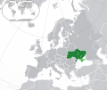
ଫାଇଲ:Europe-Ukraine (disputed territory).svg

Size of this PNG preview of this SVG file: ୭୧୩ × ୬୦୦ ପିକ୍ସେଲ. ବାକି ରେଜୋଲୁସନ: ୨୮୫ × ୨୪୦ ପିକ୍ସେଲ | ୫୭୧ × ୪୮୦ ପିକ୍ସେଲ | ୯୧୩ × ୭୬୮ ପିକ୍ସେଲ | ୧,୨୧୮ × ୧,୦୨୪ ପିକ୍ସେଲ | ୨,୪୩୫ × ୨,୦୪୮ ପିକ୍ସେଲ | ୨,୦୪୫ × ୧,୭୨୦ ପିକ୍ସେଲ.
ମୂଳ ଫାଇଲ (SVG ଫାଇଲ, ସାଧାରଣ ମାପ ୨,୦୪୫ × ୧,୭୨୦ ପିକ୍ସେଲ, ଫାଇଲ ଆକାର: ୭.୦୧ MB)
ଫାଇଲ ଇତିହାସ
ଏହା ଫାଇଲଟି ସେତେବେଳେ ଯେମିତି ଦିଶୁଥିଲା ତାହା ଦେଖିବା ପାଇଁ ତାରିଖ/ବେଳା ଉପରେ କ୍ଲିକ କରନ୍ତୁ
| ତାରିଖ/ବେଳ | ନଖ ଦେଖଣା | ଆକାର | ବ୍ୟବହାରକାରୀ | ମତାମତ | |
|---|---|---|---|---|---|
| ଏବେକାର | ୦୧:୧୩, ୮ ଜୁଲାଇ ୨୦୨୩ |  | ୨,୦୪୫ × ୧,୭୨୦ (୭.୦୧ MB) | Krestenti | update |
| ୦୬:୫୧, ୧୦ ମାର୍ଚ୍ଚ ୨୦୧୭ |  | ୨,୦୪୫ × ୧,୭୨୦ (୭.୩୮ MB) | Geom10 | fixed disputed borders | |
| ୧୭:୪୫, ୨୧ ଅକ୍ଟୋବର ୨୦୧୬ |  | ୨,୦୪୫ × ୧,୭୨୦ (୭.୩୬ MB) | Giorgi Balakhadze | Disputed areas must be differentiated from rest of the borders | |
| ୨୧:୩୯, ୧୯ ଅଗଷ୍ଟ ୨୦୧୪ |  | ୨,୦୪୫ × ୧,୭୨୦ (୭.୩୯ MB) | Rob984 | Minor | |
| ୦୧:୫୩, ୧୬ ଅଗଷ୍ଟ ୨୦୧୪ |  | ୨,୦୪୫ × ୧,୭୨୦ (୭.୩୯ MB) | Rob984 | User created page with UploadWizard |
ଫାଇଲ ବ୍ୟବହାର
ଏହି ସବୁପୃଷ୍ଠା ଏହି ଫାଇଲଟିକୁ ଯୋଡ଼ିଥାନ୍ତି:
ଜଗତ ଫାଇଲ ବ୍ୟବହାର
ତଳଲିଖିତ ଉଇକିସବୁ ଏହି ଫାଇଲଟିକୁ ବ୍ୟବହାର କରିଥାନ୍ତି:
- ar.wikipedia.orgରେ ବ୍ୟବହାର
- أوكرانيا
- مستخدم:ElWaliElAlaoui/ملعب 8
- معاملة المثليين في أوكرانيا
- مستخدم:جار الله/قائمة صور مقالات العلاقات الثنائية
- العلاقات الأوكرانية الأمريكية
- العلاقات الأنغولية الأوكرانية
- العلاقات الأوكرانية الكورية الجنوبية
- العلاقات الأوكرانية الإريترية
- العلاقات الأوكرانية السويسرية
- العلاقات الألمانية الأوكرانية
- العلاقات الأوكرانية الليختنشتانية
- العلاقات الأوكرانية البوليفية
- العلاقات الأوكرانية الموزمبيقية
- العلاقات الأوكرانية البلجيكية
- العلاقات الأوكرانية الإثيوبية
- العلاقات الأوكرانية البيلاروسية
- العلاقات الأوكرانية الطاجيكية
- العلاقات الأوكرانية الرومانية
- العلاقات الأوكرانية الأرجنتينية
- العلاقات الأوكرانية الغامبية
- العلاقات الأوكرانية القبرصية
- العلاقات الأوكرانية السيراليونية
- العلاقات الأوكرانية النيبالية
- العلاقات الأوكرانية الليبيرية
- العلاقات الأوكرانية التشيكية
- العلاقات الأوكرانية الميانمارية
- العلاقات الأوكرانية الكندية
- العلاقات الأوكرانية الزيمبابوية
- العلاقات الأوكرانية الإسرائيلية
- العلاقات الأوكرانية البالاوية
- العلاقات الأوكرانية المالية
- العلاقات الأوكرانية النيجيرية
- العلاقات الأوكرانية اليمنية
- العلاقات الأوكرانية الفانواتية
- العلاقات الأوكرانية الغابونية
- العلاقات الأوكرانية البنمية
- العلاقات الأوكرانية الكوبية
- العلاقات الأوكرانية الجورجية
- العلاقات الأوكرانية التونسية
- العلاقات الأوكرانية الكورية الشمالية
- العلاقات الأوكرانية الهندية
- العلاقات الأوكرانية اليابانية
- العلاقات الأوكرانية الإيطالية
- العلاقات الأوكرانية الناوروية
- العلاقات الأسترالية الأوكرانية
- العلاقات الأوكرانية الزامبية
- العلاقات الأوكرانية الفيجية
- العلاقات الأوكرانية المارشالية
- العلاقات الأذربيجانية الأوكرانية
- العلاقات الأوكرانية السودانية
ଏହି ଫାଇଲଟିର ଅଧିକ ବିଶ୍ୱବ୍ୟାପୀ ବ୍ୟବହାର ଦେଖନ୍ତୁ ।

