ଫାଇଲ:USA Hawaii location map.svg

ମୂଳ ଫାଇଲ (SVG ଫାଇଲ, ସାଧାରଣ ମାପ ୧,୪୪୧ × ୯୩୫ ପିକ୍ସେଲ, ଫାଇଲ ଆକାର: ୩୧ KB)
This is a file from the Wikimedia Commons. Information from its description page there is shown below. |
| ବିବରଣୀ |
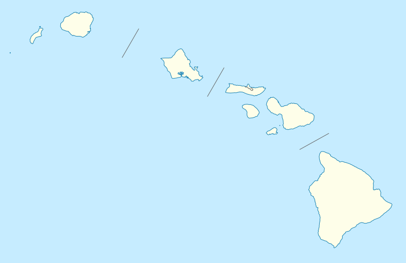
Quadratische Plattkarte, N-S-Streckung 107 %. Geographische Begrenzung der Karte:
Equirectangular projection, N/S stretching 107 %. Geographic limits of the map:
|
|
| ତାରିଖ | 09-06-2009 | |
| ମୂଳାଧାର |
own work, using
|
|
| ଲେଖକ | NordNordWest | |
| ଅନୁମତି (ଏହି ଫାଇଲକୁ ପୁଣି ବ୍ୟବହାର କରିବେ) |
ଏହି ଫାଇଲଟି କ୍ରିଏଟିଭ କମନ୍ସ ଅଧୀନରେ ଆଟ୍ରିବୁସନ ସେଆର-ଏଲାଇକ ୩.୦ ଜର୍ମାନୀ ଲାଇସେନ୍ସରେ ପଞ୍ଜିକରଣ କରାଯାଇଅଛି ।
 ଏହି ଫାଇଲଟି କ୍ରିଏଟିଭ କମନ୍ସ ଅଧୀନରେ ଆଟ୍ରିବୁସନ ସେଆର-ଏଲାଇକ ୩.୦ ଜର୍ମାନୀ ଲାଇସେନ୍ସରେ ପଞ୍ଜିକରଣ କରାଯାଇଅଛି ।
|
|
| ଅନ୍ୟ ସଂସ୍କରଣ |
Derivative works of this file: |
|
| SVG genesis | This vector image was created with Inkscape, or with something else. |


|
This map has been made or improved in the German Kartenwerkstatt (Map Lab). You can propose maps to improve as well.
|
ଫାଇଲ ଇତିହାସ
ଏହା ଫାଇଲଟି ସେତେବେଳେ ଯେମିତି ଦିଶୁଥିଲା ତାହା ଦେଖିବା ପାଇଁ ତାରିଖ/ବେଳା ଉପରେ କ୍ଲିକ କରନ୍ତୁ
| ତାରିଖ/ବେଳ | ନଖ ଦେଖଣା | ଆକାର | ବ୍ୟବହାରକାରୀ | ମତାମତ | |
|---|---|---|---|---|---|
| ଏବେକାର | ୦୦:୦୬, ୧୪ ଜୁନ ୨୦୦୯ | | ୧,୪୪୧ × ୯୩୫ (୩୧ KB) | NordNordWest | {{Information |Description= {{de|Positionskarte von Hawaii, USA}} Quadratische Plattkarte, N-S-Streckung 107 %. Geographische Begrenzung der Karte: * N: 22.4° N * S: 18.7° N * W: 160.7° W * O: 154.6° W {{en|Location map of [ |
ଫାଇଲ ବ୍ୟବହାର
ଏହି ପୃଷ୍ଠାଟି ଏହି ଫାଇଲ ସହ ଜଡ଼ିତ:
ଜଗତ ଫାଇଲ ବ୍ୟବହାର
ତଳଲିଖିତ ଉଇକିସବୁ ଏହି ଫାଇଲଟିକୁ ବ୍ୟବହାର କରିଥାନ୍ତି:
- af.wikipedia.orgରେ ବ୍ୟବହାର
- an.wikipedia.orgରେ ବ୍ୟବହାର
- ar.wikipedia.orgରେ ବ୍ୟବହାର
- ast.wikipedia.orgରେ ବ୍ୟବହାର
- Archipiélagu de Ḥawai
- Honolulu
- Sablera Lanikai
- Oahu
- Waikiki
- Haleakala
- Mauna Loa
- Observatorios de Mauna Kea
- Cadena de montes somarinos Ḥawai-Emperador
- Mauna Kea
- Pearl Harbor
- Módulu:Mapa de llocalización/datos/Ḥawai
- Módulu:Mapa de llocalización/datos/Ḥawai/usu
- Kilauea
- Wheeler Army Airfield
- Niihau
- Diamond Head (Ḥawai)
- azb.wikipedia.orgରେ ବ୍ୟବହାର
- کاهیلوئی، هاوایی
- منیل هاوایی
- وایوآینیو، هاوایی
- دیسکاوری هاربور، هاوایی
- ماهیناهینا، هاوایی
- هواولیهوا، هاوایی
- هایکو، هاوایی
- هوناناو، هاوایی
- کینی، هاوایی
- هیلهوماها، هاوایی
- وایکله، هاوایی
- لانیوپوکو، هاوایی
- میلیلانی ماکا، هاوایی
- وست لاک استیتس، هاوایی
- نīنول، هاوایی
- پاوهاو، هاوایی
- پāپاʻالوا، هاوایی
- ʻوالاپوʻ، هاوایی
- وولکانو، هاوایی
- هیلو، هاوایی
- ایشوفیلد باراکس
- کایلوا-کونا، هاوایی
- کاپولئی، هاوایی
- کیلیا، هاوایی
ଏହି ଫାଇଲଟିର ଅଧିକ ବିଶ୍ୱବ୍ୟାପୀ ବ୍ୟବହାର ଦେଖନ୍ତୁ ।